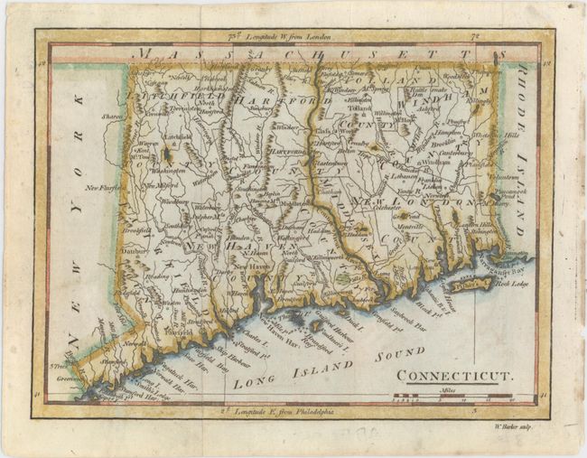
Subject: Connecticut
Period: 1796 (published)
Publication: Carey's American Pocket Atlas...
Color: Hand Color
Size:
7.6 x 5.7 inches
19.3 x 14.5 cm
Mathew Carey was a seminal figure in early American publishing; establishing the first publishing firm to specialize in cartography and issuing the first atlas devoted exclusively to American maps. He set up an elaborate cottage system of craftsmen for compiling, engraving, printing, and coloring maps. This practice was emulated by later American cartographic publishers such as John Melish and Henry S. Tanner. The American Atlas concept was also adopted by other publishers in both the United States and Europe.
This small map of Connecticut appears to be based on the map of the state engraved by Amos Doolittle a year earlier for other Carey publications. Towns and cities, counties, rivers, and mountains are depicted. New Hartford is inaccurately labeled as North Hartford. This is the first state, without roads. Engraved by William Barker.
References: Thompson #38; Wheat & Brun #286.
Condition: A
Issued folding with minor soiling.