Catalog Archive
Auction 154, Lot 165

Melish's Rare Map of the Southern United States

"A Map of the Southern Section of the United States Including the Floridas & Bahama Islands Shewing the Seat of War, in That Department", Melish, John

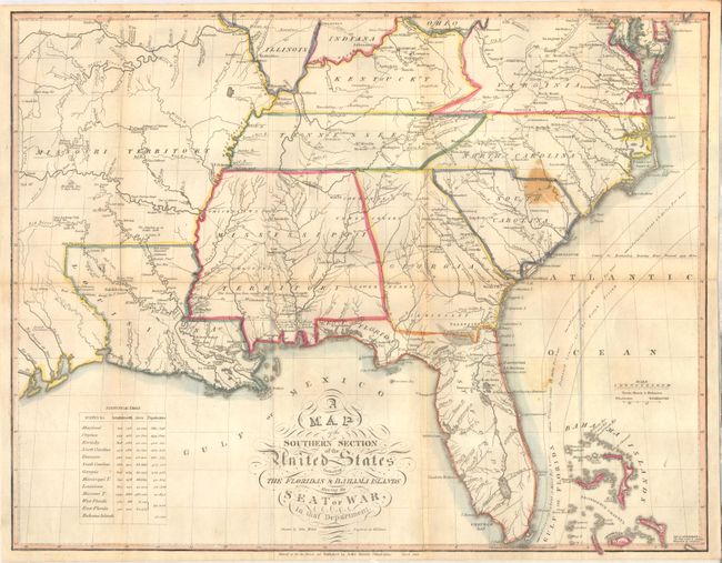
Subject: Southern United States

Period: 1813 (dated)

Publication: A Military and Topographical Atlas of the United States

Color: Hand Color

Size:
20.9 x 16.4 inches
53.1 x 41.7 cm
Download High Resolution Image
(or just click on image to launch the Zoom viewer)

A rarely seen map from Melish’s A Military and Topographical Atlas of the United States which covers the southern part of the United States during the War of 1812. The map shows a network of wagon roads with distances between points, river systems, and a number of interesting notations in Missouri Territory including "The Alligators go no Further North", "Mountains Seen 3 days Journey" and "French Hunting Camps." Florida is divided into East and West. The populations and sizes of the states, territories and the Bahama islands are noted in an inset at the lower left. Engraved by Henry Tanner.

References: Phillips (Atlases) #1346.

Condition: B

Issued folding with light toning along the folds, a few short splits at fold intersections closed on verso with archival tape, and a stain in the Carolinas.

Estimate: $1,600 - $2,000

Sold for: $1,200

Closed on 9/16/2015

Archived