Subject: Africa
Period: 1730 (circa)
Publication:
Color: Hand Color
Size:
22.6 x 18.3 inches
57.4 x 46.5 cm
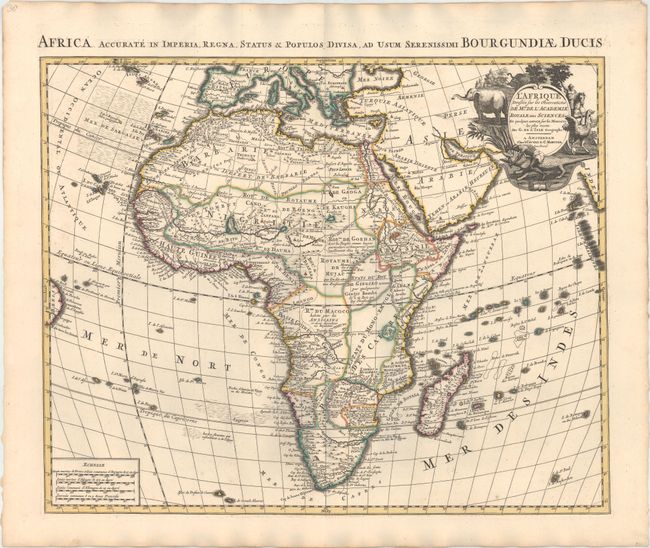
This map is based on one first issued by Delisle in 1700, which is considered one of the landmarks in the history of the mapping of Africa, and is distinguished by his scientific approach to cartography. Most of the maps of Africa issued in the eighteenth century were based on this map or his revision of 1722. The Nile is correctly shown with its origins in Abyssinia. The Nile is depicted connected to the Niger River with a conjectural line. The Congo or River Zaire, R. du Saint Esprit and the Zambezi appear in the south, along with the Dutch settlement of Hellenbok at the Cape. Several native kingdoms are named, as well as the site of various mining districts. The title cartouche is beautifully decorated with elephants, an ostrich, natives and a crocodile. A Latin title and dedication to the Duke of Burgundy appear above the map: "Africa Accurate in Imperia, Regna, Status & Populos Divisa, ad usum Serenissimi Bourgundiae Ducis."
References: Norwich #74.
Condition: A
A fine impression with original color on watermarked paper and a few insignificant spots.