Subject: Sumatra & the Malaysian Peninsula
Period: 1726 (circa)
Publication: Oud en Nieuw Oost-Indien
Color: Hand Color
Size:
23.8 x 20.1 inches
60.5 x 51.1 cm
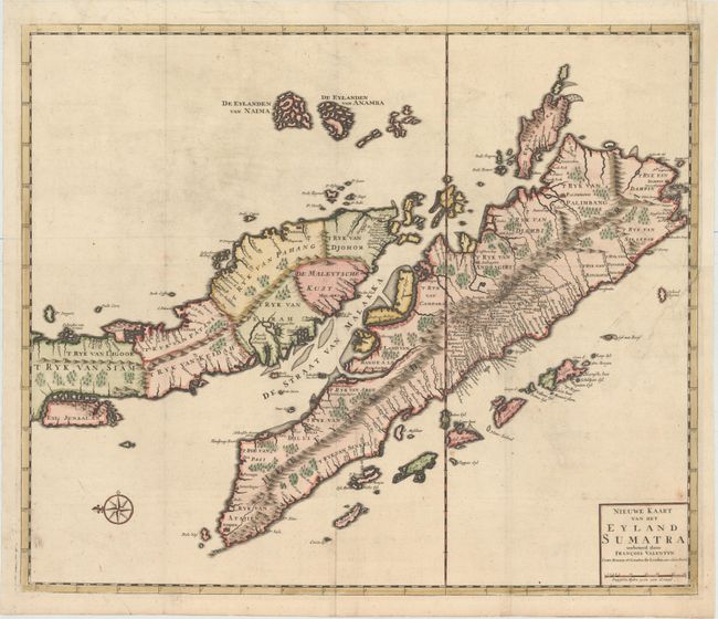
This finely engraved copper-plate chart shows all of Sumatra and the southern portion of the Malaysian peninsula. Singapore (Senafur) and Johor Bahru (Djohor) are identified in Malaysia and Palembang appears in Sumatra. Numerous small islands are also named and there is good detail of the Straits of Malacca. Valentyn was a prominent historian of the Dutch East India Company who is best known for Oud en Nieuw Oost Indien, his vast illustrated account of the Dutch trading empire in Asia. He twice traveled to the East Indies and served as Calvinist minister to Ambon between 1686 and 1694. In preparing this monumental work, he was given privileged access to the previously secret archives of the VOC, containing transcripts and copies of important earlier Dutch voyages. Valentyn's map of Sumatra and Malaya was one of the most accurate and sophisticated at the time, and served as a model for subsequent maps of the region.
References: Shirley (BL Atlases) G.VALN-1a #49.
Condition: B+
A crisp impression with attractive color and a couple of minor spots. Issued folding with a binding trim at top right that has been replaced with old paper and an adjacent binding tear that enters 3" into map and has been professionally repaired.