Subject: Southeastern France
Period: 1730 (circa)
Publication:
Color: Hand Color
Size:
23.7 x 19 inches
60.2 x 48.3 cm
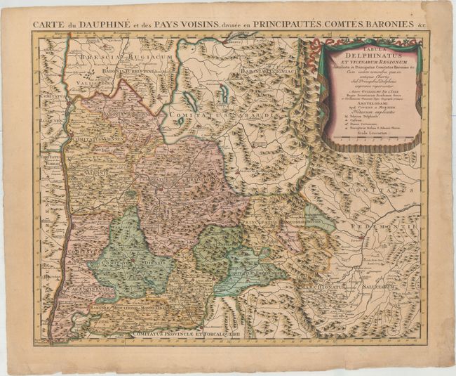
This richly detailed regional map focuses on the Rhone-Alpes region, with parts of Switzerland and Italy included as well. It stretches from the Rhone to east of Turin and from Lake Geneva south to Mont Ventoux. The mountainous terrain of the region is graphically depicted, and numerous towns, cities, political divisions, and rivers are identified. Palaces, castles, Carthusian monasteries, and perceptories of the Order of St. John can be located as well thanks to a key in the large decorative title cartouche.
References:
Condition: A
A nice impression on a watermarked sheet with full original color, a printer's crease at top, and a light damp stain that touches the neatline at top right. There are small chips and short edge tears confined to the blank margins.