Catalog Archive
Auction 153, Lot 489

"A New Map of France, Showing the Roads & Post Stages Throout That Kingdom, as Also the Errors of Sanson's Map...", Senex, John
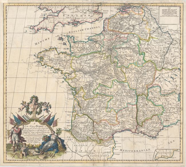
Subject: France

Period: 1719 (dated)

Publication: A New General Atlas

Color: Hand Color

Size:
22.6 x 20.1 inches
57.4 x 51.1 cm
Download High Resolution Image
(or just click on image to launch the Zoom viewer)

This elegant map of France is divided into provinces with emphasis on the roads and postal routes. The stunning title cartouche notes that the map corrects Sanson's map with data from a recent survey ordered by the late King, Louis XIV. There is a small inset of part of the coastline of Catalonia at bottom right.

References: Shirley (BL Atlases) T.SEN-2a #11.

Condition: B

A fine impression on watermarked paper with minor soiling and a number of small tears at top and bottom, some entering the map 1/2" to 2", and the majority of which have been archivally repaired. A chip at top left has also been repaired with a small portion of the neatline replaced in facsimile.

Estimate: $120 - $150

Sold for: $85

Closed on 5/20/2015

Archived