Subject: Eastern Belgium
Period: 1705 (circa)
Publication:
Color: Hand Color
Size:
23.9 x 16.1 inches
60.7 x 40.9 cm
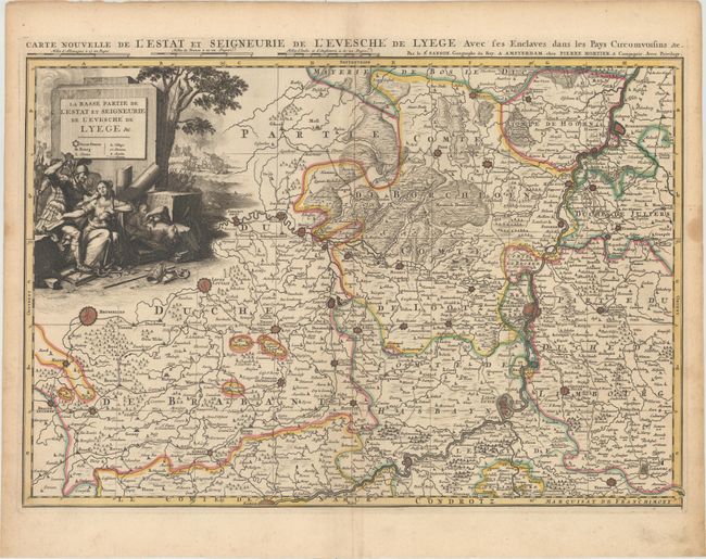
This handsome map depicts the region around Liege with excellent detail of cities, roads, rivers, and political boundaries. The largest cities are depicted with miniature bird's-eye plans. The map extends west to Brussel, east to Verviers, and north to Roermond in the Netherlands. A large tragic title cartouche fills the upper left corner with a soldier raising a dagger to a woman with a child in her lap, while a scene of pillaging and burning a village appears in the background. An alternate title appears above the map: "Carte Nouvelle de l'Estat et Seigneurie de l'Evesche de Lyege avec les Enclaves dans les Pays Circomvoisins &c."
References:
Condition: A
An excellent impression with original color, marginal soiling, and a stain in right blank margin.