Subject: Europe
Period: 1711 (circa)
Publication: Introductio in Universam Geographicam
Color: Hand Color
Size:
10 x 8 inches
25.4 x 20.3 cm
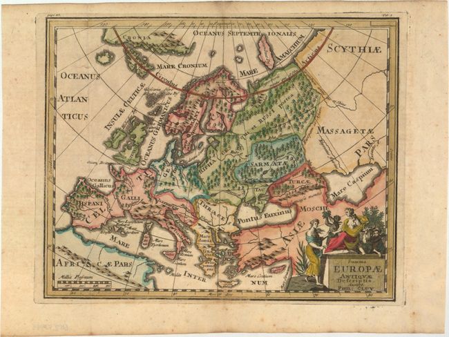
This map of Europe shows its ancient divisions, as it was in the time of the Roman emperors, and is fully engraved with forests. In the Arctic Ocean are a landmass labeled Cronia and an island labeled Carambuce Ins. The title cartouche is topped with allegorical female figures.
Cluver's Introductio in Universam Geographicam was a popular atlas, appearing in over 45 editions during a 100-year period. The first edition was published without maps in the 1620s, and the first edition to include maps was published circa 1641. The various editions were published in different cities throughout Europe, including Amsterdam, Nuremberg, and London. This map is from a London edition, with the majority of the maps re-engraved by John Senex.
References: Shirley (BL Atlases) T.CLUV-9a #3.
Condition: A
A fine impression with attractive color on watermarked paper, a minor mis-fold, and several spots of foxing in the bottom blank margin. Issued folding.