Subject: Panama
Period: 1792 (dated)
Publication:
Color: Hand Color
Size:
15.3 x 12.5 inches
38.9 x 31.8 cm
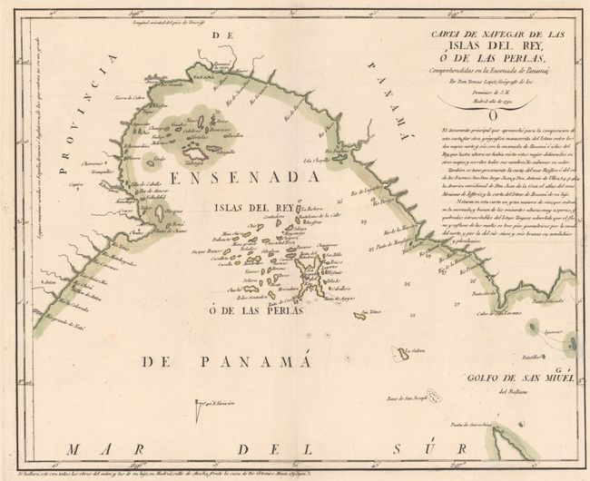
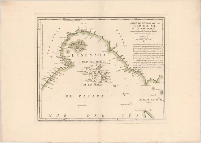
This scarce map was published by one of the most distinguished Spanish cartographers of the eighteenth century, Lopez de Vargas Machuca (1730-1802), who was Geographer to the King of Spain. The map depicts the Pearl Islands in the Gulf of Panama, the largest of which is the Isla del Rey, depicted at center. The map shows good detail of the numerous tiny islands as well as the coast of Panama along the Gulf. Soundings, rocks, and anchorages are indicated. Below the title is a long note explaining the sources for the cartography, including an anonymous map, a map of the Pacific by Antonio de Ulloa, a map of South America by Juan de la Cruz, and Jefferys' "atlas of Mexico." A very rare map, as few Spanish maps were ever published. We were only able to find two examples of this map being offered for sale in the last 30 years.
References: Kapp (MCC-73) #90.
Condition: A+
Excellent impression and original color on watermarked paper with wide margins. There is very minor soiling in the blank margins.