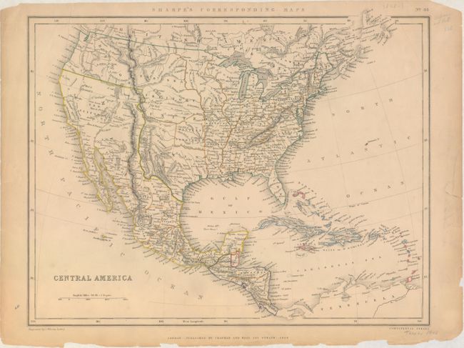
Subject: United States, Mexico & Central America
Period: 1848 (dated)
Publication: Sharpe's Corresponding Maps
Color: Hand Color
Size:
16.1 x 12.7 inches
40.9 x 32.3 cm
Despite its title, this map covers the entire United States and extends south to include Mexico and Central America. The new state of Texas is shown in its large stovepipe configuration, while Mexico is still in control of California and the Southwest. Present-day Oklahoma is named Western Territory and a huge Nebraska Territory occupies the region between the Rockies and the Missouri River. An undivided Dacota Iowa Territory takes up the region between the Missouri and Mississippi rivers. The map shows good detail of forts, settlements, rivers and topography.
References:
Condition: B
Original outline color with an edge tear at top left that extends 3.5" into the image closed on verso with archival tape. There is light toning along the sheet edges with several small edge chips and other edge tears confined to the blank margins.