Subject: Ohio
Period: 1834 (circa)
Publication:
Color: Black & White
Size:
7.9 x 9.9 inches
20.1 x 25.1 cm
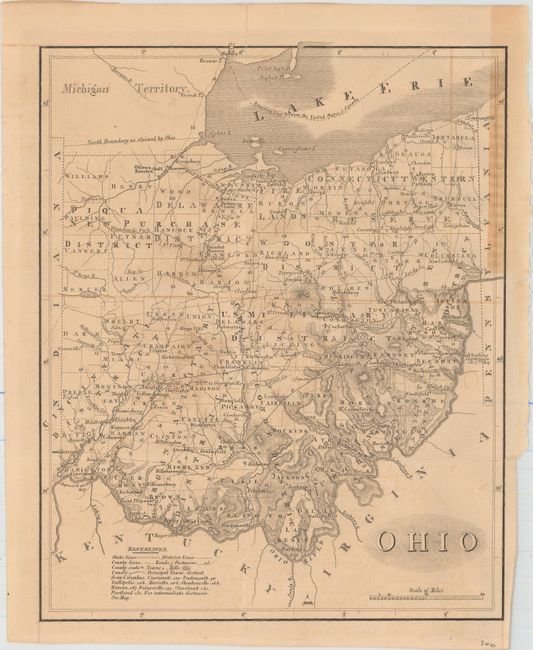
This highly detailed map of the state is delineated by county, including the recently organized counties in the northwest corner of the state. In addition to counties, the map identifies land districts and bounty grants including the Connecticut Western Reserve and the Virginia Military District. It also provides excellent information on topography, roads, towns, and forts and Indian Reservations. At the top of the state is the disputed boundary with Michigan before the outbreak of the bloodless Toledo War of 1835 and 1836. That conflict occurred over a sliver of land called the Toledo Strip, a 468 square mile stretch of land that both Ohio and Michigan territory claimed as their own. They actually both raised militias and threatened each other from the banks of the Maumee River, but nothing more severe than taunting ensued. Michigan acquiesced to Ohio's border demands in order to be admitted to the Union in 1837, gaining the mineral-rich Upper Peninsula as a consolation prize.
References:
Condition: B
Issued folding on paper with a partial "J. Whatman" watermark, with a few short fold separations that have been closed on verso with Japanese tissue. Faint offsetting with a few areas of light toning.