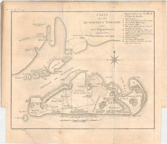
Subject: Martha's Vineyard, Massachusetts
Period: 1787 (published)
Publication: Lettres d'un Cultivateur Americain
Color: Black & White
Size:
10.3 x 8.3 inches
26.2 x 21.1 cm
This rare copper engraved map covers Martha’s Vineyard, the Elizabeth Islands and a portion of Cape Cod. On the Vineyard, details include roads, natural features, towns and villages, and two meeting houses. Also locates Tidsbury Wood Land south of Tidsbury Town, Eel Pond, Peat Swamp, Squidnoket Pastures, and Cape Pog Pond. The legend at upper right identifies ten features on the map with more information. A most desirable and early map of Martha's Vineyard. Engraved by Pierre Francois Tardieu.
Crevecoeur was a French-born surveyor who settled in New York, where he produced this classic collection of twelve essays that reflected on the nature of American life, particularly its customs and manners. His description of bountiful American lands spurred many French people to immigrate to America. Howes says that Crevecoeur's work is a: "Description of American life of great influence in attracting European immigration in the post-revolutionary period. As literature unexcelled by any American work of the eighteenth century."
References: Howes #C883.
Condition: B+
Issued folding on watermarked paper with light offsetting and a few tiny spots. There is a short binding tear confined to the right blank margin.