Subject: Maine
Period: 1850-84 (dated)
Publication:
Color: Hand Color
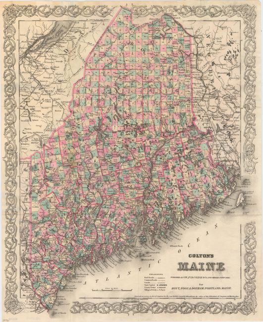
A. Colton's Maine, by G.W. & C.B. Colton, dated 1884 (13.0 x 16.0"). This pocket map individually colors each township and depicts roads, towns and villages, rivers, railroads and topography. Printed on fine banknote quality paper, the map is surrounded with Colton's trademark strapwork border. Condition: Issued folding on watermarked paper with a minor spot of toning where the map was glued onto covers, which are no longer present.
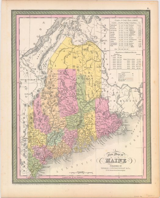
B. A New Map of Maine, by Thomas, Cowperthwait & Co., dated 1850 (12.1 x 15.1"). Attractive map of the state is delineated by county and shows railroads, roads, towns and settlements. Depicts the old "Boundary according to the Treaty of 1783" in Quebec about 15 miles to the north of the final settled boundary. Tables at top right show the population by county as well as the population growth over time from 1765 to 1850. Condition: Light toning along sheet edges.
References:
Condition: A
See description above.