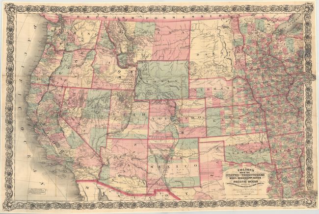
Subject: Western United States
Period: 1869 (dated)
Publication:
Color: Hand Color
Size:
42.4 x 28.9 inches
107.7 x 73.4 cm
This very large and detailed map covers the region from Chicago and New Orleans west to the Pacific Ocean. It is absolutely filled with detail including proposed and existing railroads, wagon roads, the Pony Express route, Fremont's exploration routes and dates, and much more. Of particular interest is the Pacific Railroad which is shown as complete, linking Council Bluffs, Iowa to San Francisco. Yellowstone National Park does not yet appear in the newly organized Wyoming Territory. Decorated by an elaborate border with a small advertisement at bottom indicating "maps of every description to accompany Reports Prospectuses etc." Original pocket covers are not present.
References: cf. Wheat (TMW) #1099.
Condition: B
Originally issued folding and now backed with stiff linen to reinforce and repair a long separation along a horizontal fold and numerous small splits at fold intersections resulting in minor loss. There is an additional small area of loss in eastern Nevada and minor toning along a few folds.