Subject: Minnesota, Iowa, Wisconsin
Period: 1862-81 (circa)
Publication:
Color:
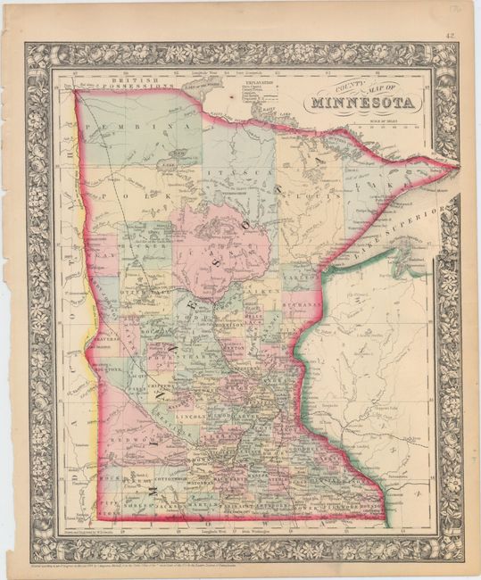
A. County Map of Minnesota, by Samuel Augustus Mitchell, dated 1862, hand color (11.5 x 13.9"). This detailed map locates counties, towns and cities, roads, Indian agencies, rivers, lakes, and railroads both proposed and operational. County configuration is up to date, but the locations of Rock and Pipestone counties in the southwest corner of the state are inexplicably reversed. There are brief notes on the rivers and geography dispersed throughout, such as Dividing Ridge between the Water's flowing into the Hudson's Bay and Highest point reached by Steamboat in 1858. The map is surrounded by a lovely floral border. Drawn and engraved by W.H. Gamble. Condition: There are a couple minor spots in the image and an edge tear at right that just touches the border. Tiny chips appear in the left blank margin, and there is marginal toning.
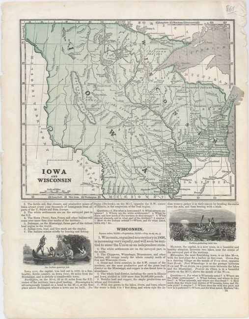
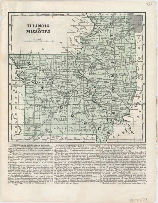
B. Iowa and Wisconsin [on verso] Illinois and Missouri, by Sidney E. Morse, from A System of Geography..., circa 1846, printed color (8.6 x 6.9"). This sheet comes from a geography book and includes Iowa, present-day Minnesota, and Wisconsin on recto and Illinois and Missouri on verso. The county configuration, lack of a Minnesota Territory, and the text's assertion that Wisconsin is soon to enter the Union date the maps to circa 1844. There are two vignettes beneath the map of Iowa and Wisconsin, one depicting a Sac Indian fishing and the other showing Indians gathering wild rice. Condition: Minor show-through of text on verso and some short edge tears and chips that do not enter into map image.
References:
Condition: A
See description above.