Subject: Central United States, Railroads
Period: 1868 (dated)
Publication:
Color: Hand Color
Size:
24.1 x 33 inches
61.2 x 83.8 cm
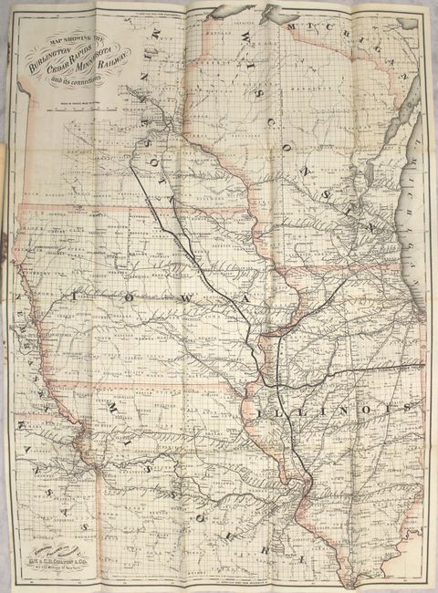
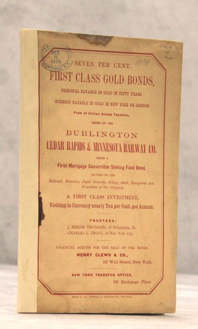
This map covers the region from St. Louis to Minneapolis and is centered on the Burlington Cedar Rapids and Minnesota Railway, which runs from Burlington, Iowa to Mankato, Minnesota. Numerous other railroads are depicted including the Toledo Peoria & Warsaw and the Rockford Rock Island & St. Louis railroads. Delineated by county, the map shows numerous cities and towns, the river system, and the growing railroad network. The map was issued as part of a bond offering to raise funds for the line, offering investors a 7% return (the company later went bankrupt). Includes 36-pages of text. Folds into cream-colored paper wrappers.
References:
Condition: B+
Issued folding with a small brown stain along two folds at top and in the left blank margin. The map was detached from the pamphlet and reattached along the left margin using archival tape. Pamphlet text is very good, and the covers have several damp stains and an owner's stamp at top left. Spine has been reinforced with paper tape.