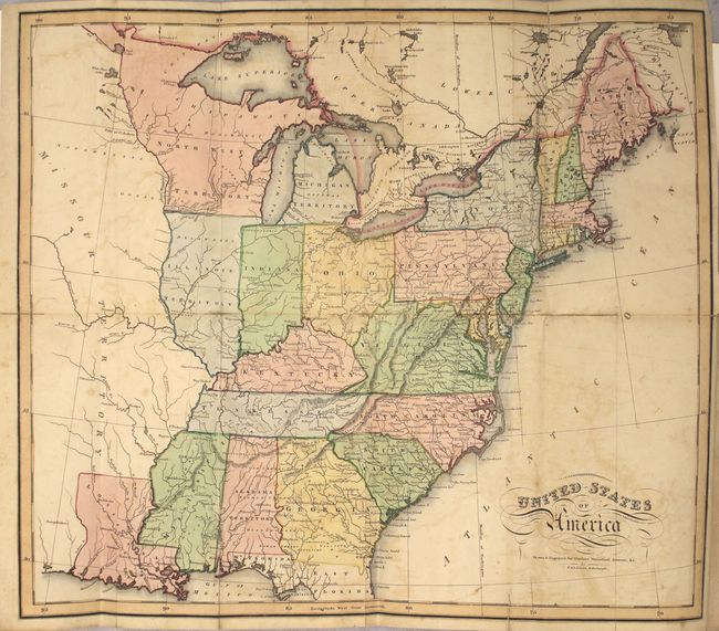
Subject: Eastern United States
Period: 1819 (circa)
Publication:
Color: Hand Color
Size:
17.8 x 15.3 inches
45.2 x 38.9 cm
This handsome map shows the young United States with political development confined to east of the Mississippi River and the state of Louisiana. Missouri Territory takes in all the plains region west of the Mississippi and the North West Territory contains the future Upper Peninsula of Michigan, Wisconsin and Minnesota. The map provides good information on the early roads and locates Indian villages, hunting grounds, and forts.
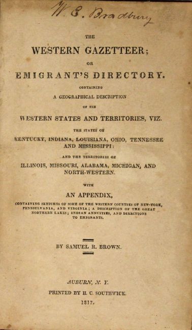
The map has been bound into the front of Samuel Brown's The Western Gazetteer; or Emigrant's Directory…, published in 1817, which focuses on the region to the west of the Appalachian mountains and describes the climate, vegetation, development and economies of these states and territories. Howes describes it as one of the earliest American-printed emigrant's guides. The map was likely added when it was rebound as Howes does not indicate any maps were published in the guide. 360 pp., octavo, rebound in faux red leather and tips over marbled paper boards with gilt titling and raised bands on spine.
References: Howes #B867.
Condition: B
The map, backed with linen, has light offsetting, a few spots of foxing, and numerous fold separations closed on verso with archival material. Text has scattered foxing and toning. New binding is fine with ex-library bookplate on front pastedown.