Subject: North America
Period: 1720 (circa)
Publication: Atlas Historique
Color: Hand Color
Size:
23.4 x 18.5 inches
59.4 x 47 cm
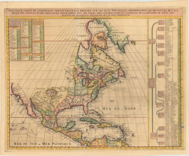
This is Chatelain's re-engraved version of Delisle's foundation map of North America. The cartography is nearly identical to the Delisle map, with California returned to its peninsular position rather than as an island. Mendocin is the farthest northern point on California, and the northwest portion of the continent is left blank. The Great Lakes are well-defined, based on Coronelli. The Mississippi River valley is well developed with recent French settlements. A chart to the right lists the primary divisions of North America with colonial interests, native tribes, and towns.
References: Lowery #263; Phillips (A) #579-6.
Condition: B+
A dark impression issued folding, now pressed, with a tiny horizontal fold separation in the Gulf of Mexico that has been repaired and reinforced on verso. There is a small tear just passing the neatline near the lower centerfold that has been repaired with archival tape on verso and a few fold separations confined to the top and left blank margins. Remnants of hinge tape on verso.