Subject: Exploration and Surveys, Panama Canal
Period: 1839 (published)
Publication: HR Doc. 322, 25th Congress, 3rd Session
Color: Black & White
Size:
6.3 x 9.4 inches
16 x 23.9 cm
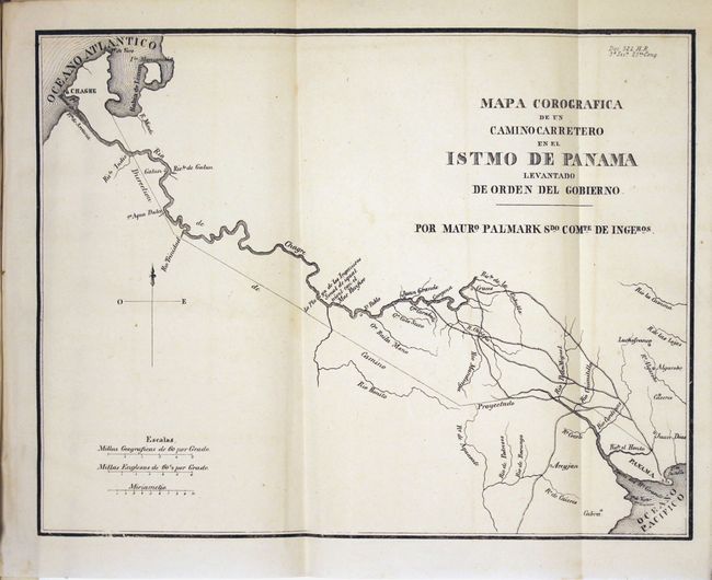
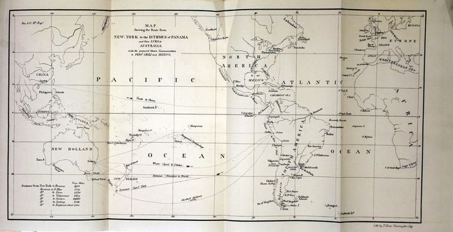
This 167-page report, from the House Committee on Roads and Canals, details several possible scenarios for opening a "communication" (railroad or canal) between the Atlantic and Pacific Oceans, with a recommendation that the House of Representatives approve a resolution for the President to enter negotiations with the government of Panama to create a canal. The report includes a profile view from Lake Nicaragua to the Pacific Ocean and the following four maps:
Map Showing the Route from New-York to the Isthmus of Panama (14.2 x 7.1")
Isthme de Tehuantepec (15.6 x 10.8")
Mapa Corografica de un Camino Carretero en el Istmo de Panama…(9.3 x 7.2")
Plan of That Part of the Isthmus of Panama Eligible for Effecting a Communication between the Atlantic & Pacific…, by J.A. Lloyd (10.2 x 8.5")
Rebound in quarter red maroon cloth and tips over decorative green paper boards.
References: Claussen & Friis #310, 311, 313-315.
Condition: A
Condition code is for the maps and plate which are near fine. Text has scattered foxing with about a quarter of the pages toned. New binding is pristine.