Subject: Atlases
Period: 1826 (dated)
Publication:
Color: Hand Color
Size:
6 x 9 inches
15.2 x 22.9 cm
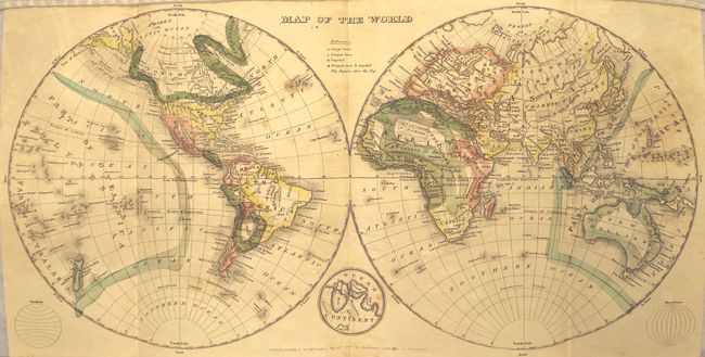
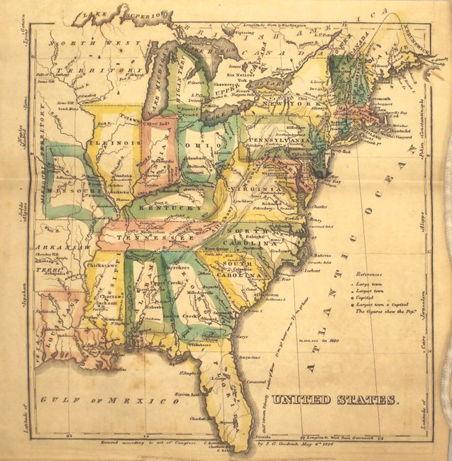
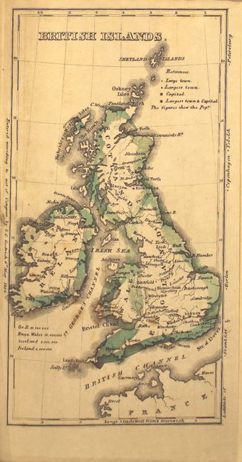
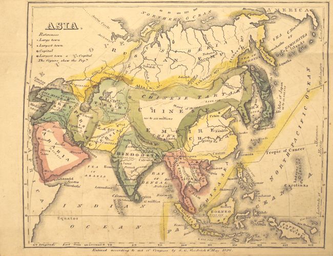
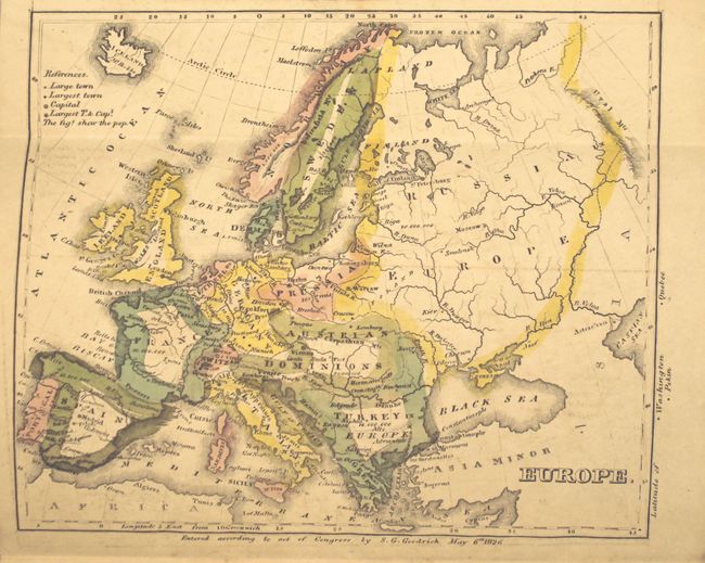
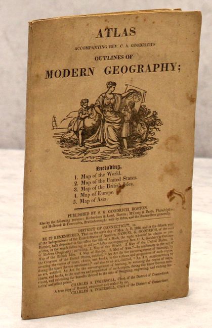
This rare school atlas is one of the earliest, if not the earliest, atlases published by S.G. Goodrich. It contains five maps including: the World (16 x 9"), United States (7.7 x 7.7"), Asia (5.8 x 7.3") , Europe (6.2 x 7.3") and the British Isles (4 x 7.7"). The map of the United States extends west to Missouri, Louisiana and Arkansas Territory. Above Illinois is a large Northwest Territory that encompasses Wisconsin, the upper peninsula of Michigan, and a small portion of Minnesota. Towns, capitals and a few Indian tribes are identified. The only text accompanying the maps is two pages of advertising detailing Goodrich's other publications available for sale that are "sold at low prices." Octavo, pictorial paper wrappers.
References:
Condition: B+
The maps, in original outline color, are very good with some light foxing and faint offsetting. Paper covers are excellent considering their age with some moderate soiling.