Subject: Atlases, Asia
Period: 1658 (published)
Publication:
Color: Hand Color
Size:
7.3 x 10 inches
18.5 x 25.4 cm
Nicolas Sanson was one of the foremost French cartographers of the 17th century, and is often considered as the "father" of French cartography. By around 1640, the French market in maps and atlases surpassed that of the Dutch, thereby initiating the Golden Age of French cartography. Born in Abbeville in December 1600, Nicolas Sanson was educated by the Jesuits in nearby Amiens. He studied history, and it is believed that he turned to cartography simply as a means to illustrate history. His maps soon came to the attention of Cardinal Richelieu, King Louis XIII's chief minister, and Sanson was asked to tutor the king in geography. Louis XIII later appointed Sanson "Geographe Ordinaire du Roy" (Geographer to the King). This appointment helped both expand and protect Sanson's role in the French map market. After a failed partnership with Melchoir Tavernier, an engraver and dealer of maps in Paris, Sanson began to edit and publish his work on his own. The most significant works that Sanson edited on his own were his quarto atlases of the four continents - L'Europe, L'Asia, L'Afrique, and L'Amerique - which he published beginning in 1647.
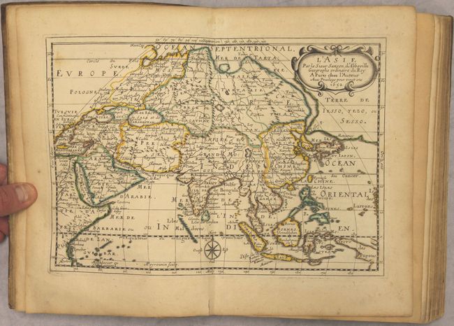
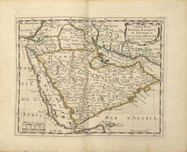
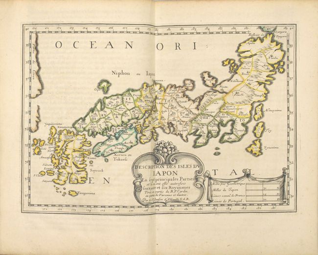
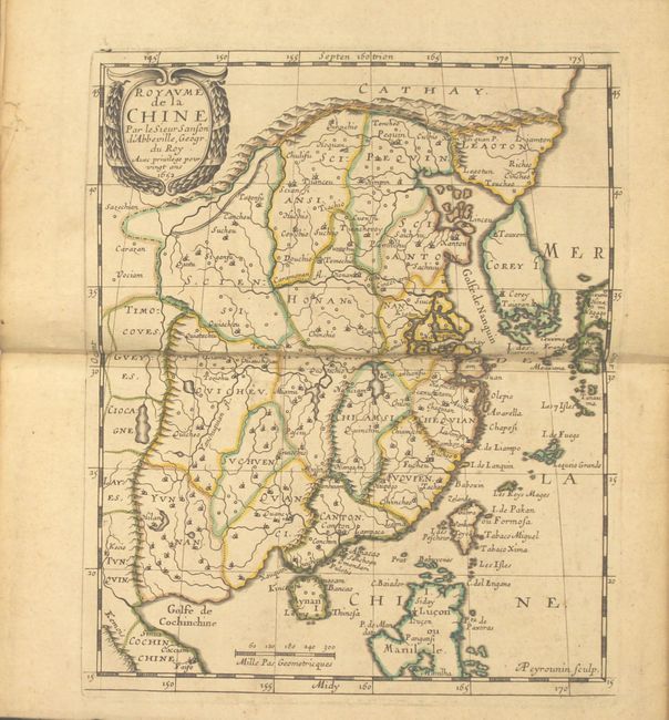
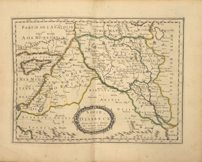
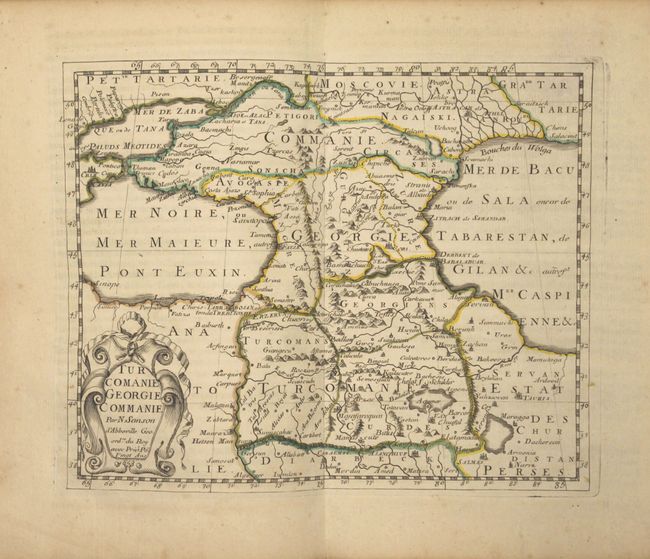
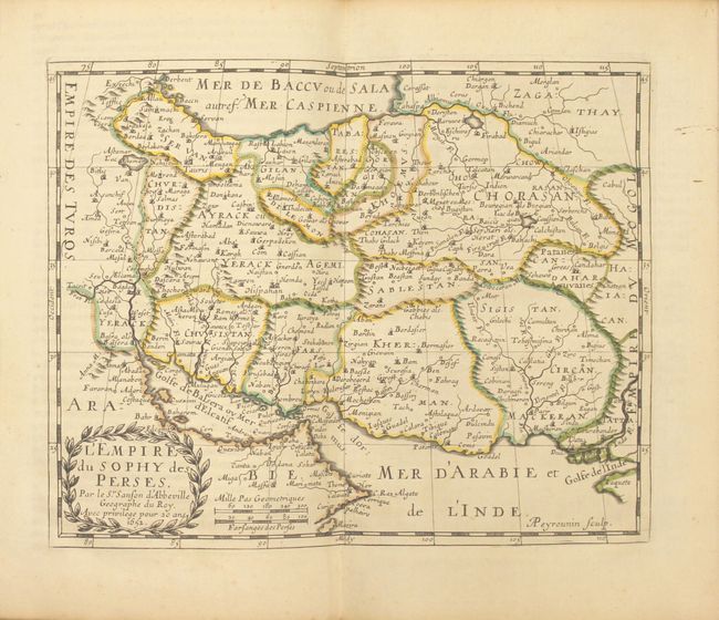
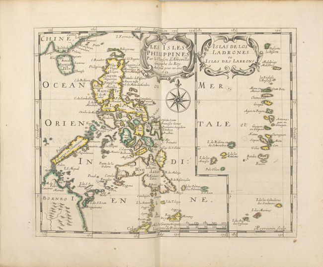
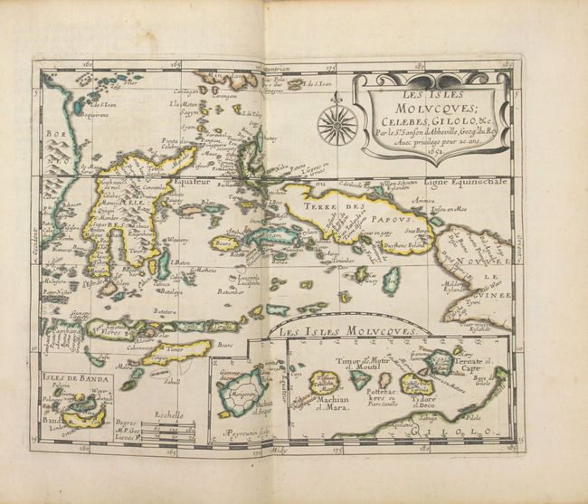
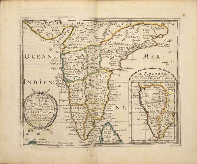
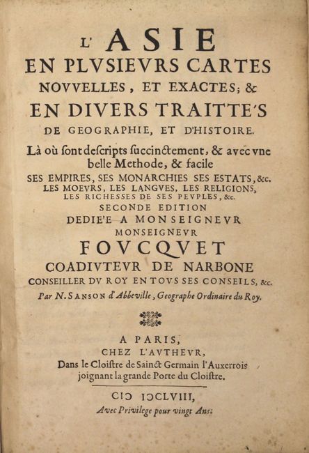
This is the second edition of Sanson's desirable atlas of Asia, complete with 17 maps accompanied by corresponding text. Sanson credits numerous sources for the maps and text, including the ancient geographers (Ptolemy, Pliny and Holy Scripture), the Arabs Al-Idrisi and Oulough Beg, the histories of explorers by Linschoten and Samuel Purchas, and the great Dutch cartographers of the 16th and early 17th centuries (Mercator, Hondius, Jansson, Blaeu and Visscher). Sanson also acknowledges the work of the Jesuits for his maps of China and Japan. The maps are: L'Asie, Turquie en Asie, Anatolie, Sorie, Turcomanie Georgie Commanie, L'Arabie, L'Empire du Sophy, L'Empire du Grand Mogol, Presqu'Isle de l'Inde deca la Gange, Partie de l'Inde audela du Gange, Royaume de la Chine, La Grande Tartarie, Description des Isles du Japon, Les Isles Philippines, Les Isles Molucques, Les Isles de la Sonde, and Ceylan et les Maldives. The maps are identical to those in the first edition with the exception of the map of Japan, which was re-engraved. It is likely that all the maps were engraved by A. Peyrounin, as his imprint appears on 12 of the maps. The title page and four pages of text dedicate this second edition to Francois Fouquet, the brother of the Superintendent of Finances in France. This edition also includes 14 pages of additional text at the end of the atlas with brief descriptions on the continents of Europe and the Americas, likely inserted to encourage readers to purchase Sanson's quarto atlases of those continents.
The map of Asia is important in the cartographic development of the region. It diverges from Sanson's folio map of 1650 in the appearance of a new landmass to the north of Japan labeled Terre de Iesso, Yezo ou Sesso. Sanson's depiction of this region is a combination of the reports of recent Dutch discoveries by De Vries and speculations of De Gama's discovery of a large landmass in the north Pacific. Japan is shown based on Jesuit sources and Korea is a globular-shaped island. There are four rivers flowing south out of the mythical Lac de Chiamay, which appears west of China. The map of Arabia is based on Sanson's folio-sized map of the region, with spurious mountain ranges and a distorted Red Sea, also named the Sea of Mecca (Mer de la Mecque). The re-engraved map of Japan shows greatly improved geography of Honshu, Kyushu, and Shikoku based on the Blancus/Moreira type, with just the southern tip of Hokkaido appearing. Korea, which was depicted as an island in the 1652 edition of the map of Japan as well as in the maps of China and the Asian continent, now appears as a peninsula and is labeled Partie de Corea as opposed to Isle de Corey.
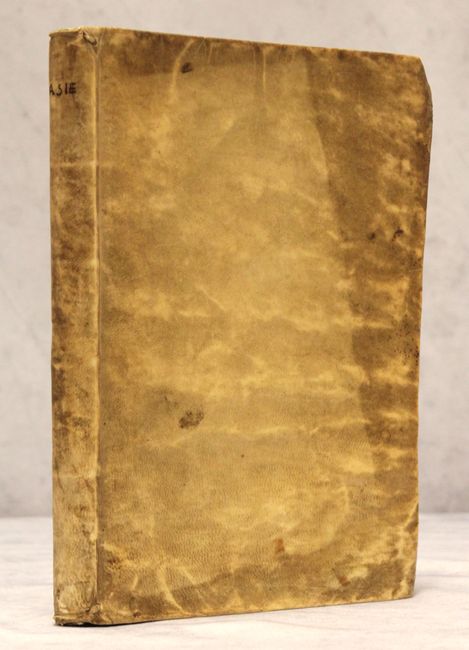
Complete with title page, dedication, 17 maps, 104 + 14 pp. text. Small Quarto. Original full vellum binding with manuscript title on spine.
References: Pastoureau, SANSON III B; Yeo #46; Walter #OAG-27; cf. Ankary #61.
Condition: A
The maps are clean and bright with original outline color and sharp impressions. A few maps have a minor spot in the image or marginal soiling, and the map of Asia has a short marginal tear. The beginning of the text is very lightly toned with occasional minor soiling throughout. The binding is sound and the covers are soiled.