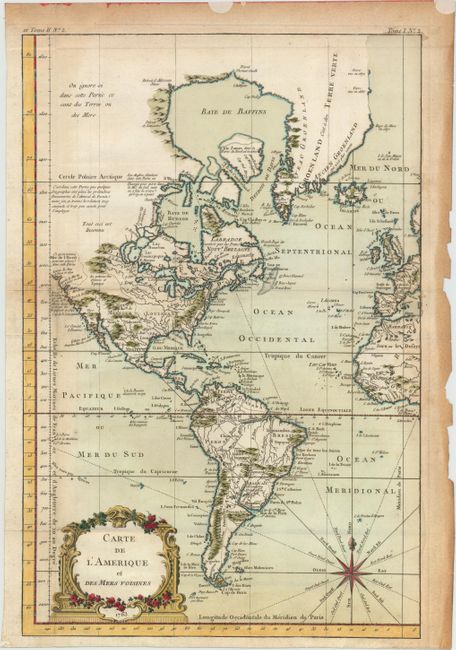
Subject: Western Hemisphere - America
Period: 1763 (dated)
Publication: La Petite Atlas Maritime
Color: Hand Color
Size:
11.9 x 18 inches
30.2 x 45.7 cm
A handsome map that shows the Western Hemisphere from Cape Horn to Baffin Bay, and from a note on the Mer de l'Ouest, or Sea of the West, to the western fringes of Europe and Africa. The Northwestern United States and Canada are unexplored and left blank but for several notations regarding the unlikelihood of a northwest passage or the discoveries of Admiral de Fonte. A bold engraving on thick paper decorated with an attractive rococo-style cartouche and compass rose.
References:
Condition: B+
Issued folding on watermarked paper with attractive color and minor offsetting. There is very light toning in the map, and moderate toning along the edges of the sheet at top and right, causing several small chips at right. There are remnants of labels in top blank margin, far from image.