Catalog Archive
Auction 152, Lot 699

"Kartenskizze von Zulu-Land und den Goldfeldern der Sudafrikanischen Republik...", Petermann, Augustus Herman

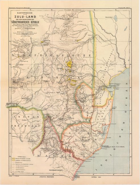
Subject: Southeastern Africa

Period: 1885 (dated)

Publication: Petermanns Geographische Mitteilungen

Color: Printed Color

Size:
13.1 x 17.9 inches
33.3 x 45.5 cm
Download High Resolution Image
(or just click on image to launch the Zoom viewer)

This handsome map shows the configuration of the southeastern coast of Africa after the Zulu and First Anglo-Boer wars. The area is divided into Sudafrikanische Republik, Portuguese possessions, Swaziland, Gebiet von Amatonga, Zulu Land, Natal, and the Orange Free State. There is nice topographical detail, and a key at bottom left identifies gold mining areas, roads, railroads, and surveys of the region. Published by Justus Perthes.

References:

Condition: A

Issued folding with a tiny hole at the fold intersection, a hint of offsetting, and an edge tear in the left blank margin that has been closed on verso with archival tape.

Estimate: $90 - $120

Sold for: $90

Closed on 2/18/2015

Archived