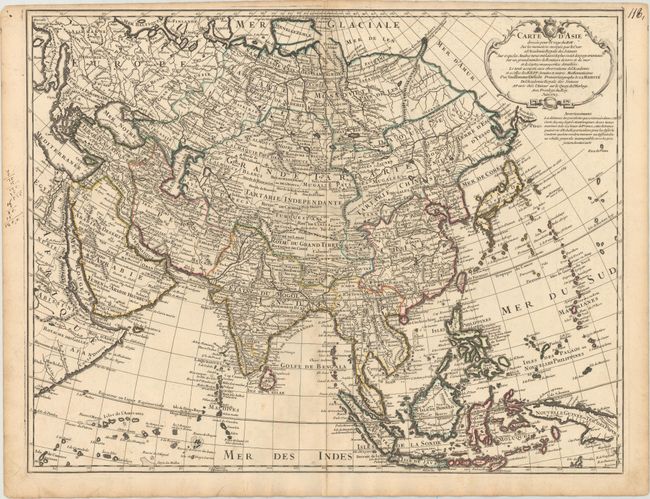
Subject: Asia
Period: 1723 (dated)
Publication:
Color: Hand Color
Size:
24.6 x 19.1 inches
62.5 x 48.5 cm
This uncommon map of Asia is similar to Delisle's earlier map of the continent published circa 1700, albeit with some updates. The coastline of Siberia is filled in between an incomplete Novaya Zemlya and Japan, with Witsen's mountainous peninsula that juts into the sea appearing as Cap Glace. Hokkaido is connected to the mainland and called Terre d'Eso ou d'Yesso. Nearby, there is a fragment of shoreline from the mythical Terre de la Compagnie across the Detr. d'Vries from the I. de Etats. Korea is rendered in an oddly squat and square shape. The Sea of Japan or East Sea is here identified as Mer de Coree. Delisle utilized the recent surveys of the Jesuits in his accurate outline of India and mapping of China. A decorative title cartouche appears in the top right corner.
References: Yeo #118.
Condition: A
On watermarked paper with very minor soiling, a hint of offsetting, and a short printer's crease along the centerfold at bottom.


