Subject: Holy Land
Period: 1741 (circa)
Publication: Grosser Atlas...
Color: Hand Color
Size:
22.6 x 19.6 inches
57.4 x 49.8 cm
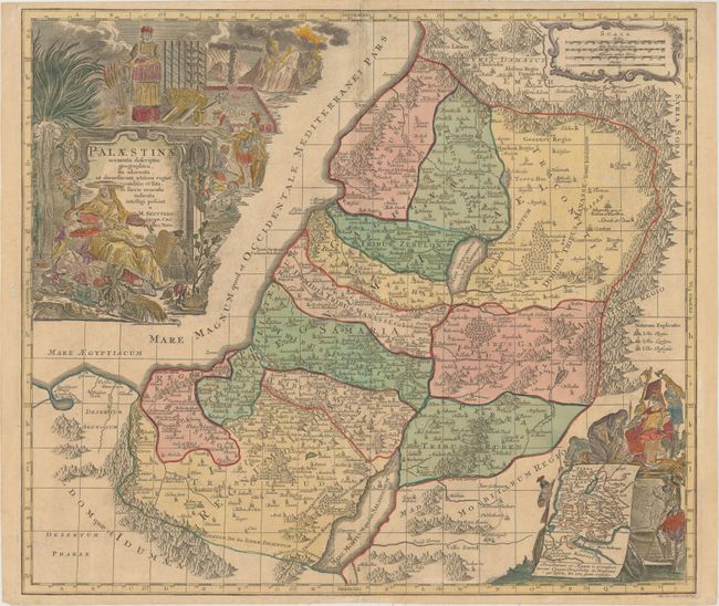
This scarce map of the Holy Land is based on Homann's map of Palestine, which is derived from Guillaume Sanson. It presents the region divided among the twelve tribes of Israel and covers from Sidon to Sirbonis L in the Egyptian desert. The Kishon River is shown as connecting the Mediterranean Sea with the Sea of Galilea. In an inset at bottom right is a map showing the Exodus and Wandering surrounded by the Roman captors of Judea. The dramatic title cartouche features a female figure being offered a crown, presumably the Empress Maria Theresia, who succeeded her father, Emperor Charles VI, in 1740. Engraved by Tobias Conrad Lotter; the title cartouche was engraved by G. Eichler.
References: Laor #721.
Condition: B+
Original color in the map with later color in the cartouches and minor toning. There are a few archival repairs along the centerfold.