Subject: Dalmatian Islands, Croatia
Period: 1780 (dated)
Publication: Atlas Universel...
Color: Hand Color
Size:
24.2 x 18.3 inches
61.5 x 46.5 cm
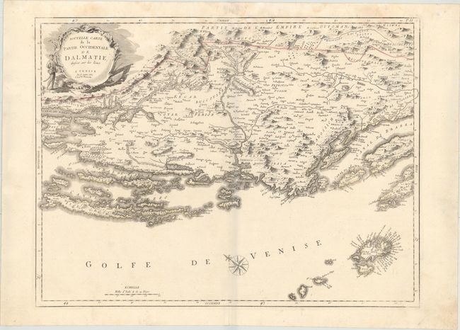
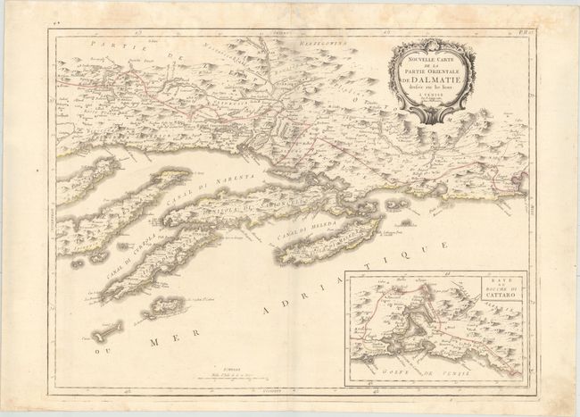
This striking pair of maps details the islands off the coast of the Dalmatia region in Croatia. The first sheet spans from the southern part of the island Pag to the northern half of Brac, the largest island in Dalmatia. The second sheet centers on the Peljesac peninsula and extends to include Hvar (the longest island in the Adriatic), Korcula, Mljet, and numerous smaller islands. An inset at bottom right details the Bay of Kotor. There is excellent topographical detail throughout that emphasizes the mountainous terrain of the region. Decorative title cartouches adorn each sheet, with the western sheet featuring a figure in local dress and martial imagery. North is oriented to the left on both sheets. Each sheet stands on its own with a title cartouche and full borders. Size varies slightly.
References:
Condition: B+
Original outline color on sturdy watermarked sheets with light damp stains entering the map images at top and marginal soiling.