Subject: Eastern Europe
Period: 1777 (dated)
Publication: Atlas Universel...
Color: Hand Color
Size:
21.9 x 16.8 inches
55.6 x 42.7 cm
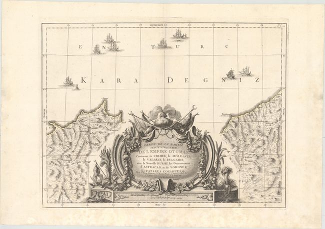
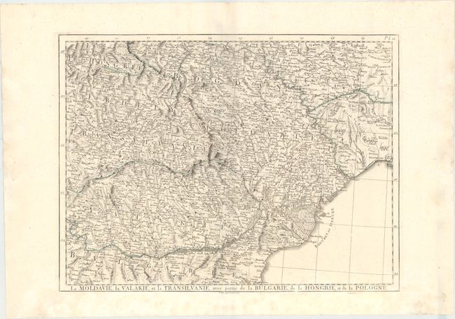
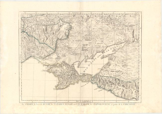
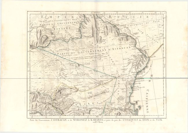
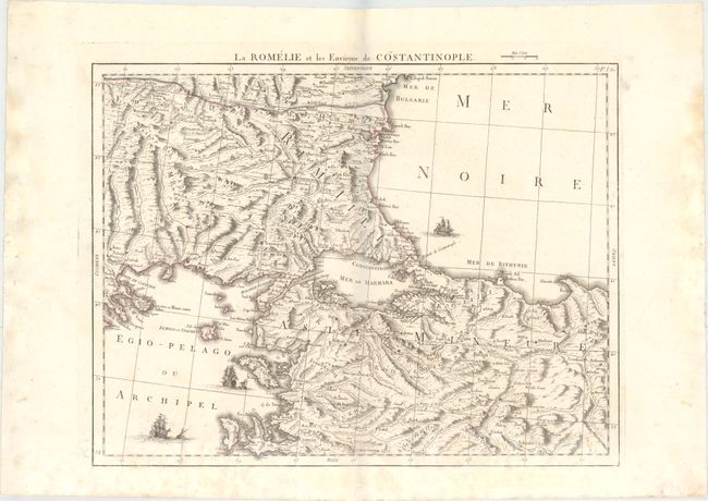
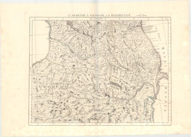
This massive map of the Ottoman Empire in Europe stretches over six sheets. It is based on the 1774 map by Giovanni Antonio Rizzi-Zannoni. The map spans from the Balkans along the Black Sea and south to Turkey across to the western edge of the Caspian Sea. There is excellent topographical detail, and a number of towns, cities, and rivers are shown. Political divisions are delineated, and several tent villages are located, with the heaviest concentration north of the Sea of Azov. The Black Sea is filled with sailing vessels. Notes scattered throughout refer to battles and interesting phenomena in the region. The lower central sheet is dominated by a massive decorative title cartouche. The remainder of the sheets include alternate titles outside their neatlines. Each map stand on its own with full borders.
References:
Condition: B+
Original outline color on sturdy watermarked sheets with light damp stains mostly confined to the bottom of each sheet and minor marginal soiling.