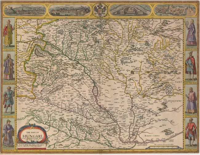
Subject: Hungary
Period: 1626 (dated)
Publication: A Prospect of the Most Famous Parts of the World
Color: Hand Color
Size:
20.3 x 15.5 inches
51.6 x 39.4 cm
This handsome carte-a-figures map of Hungary is centered on Budapest and extends west to Vienna. The Danube River and its tributaries are prominently shown flowing diagonally across the map. The map is flanked by male and female figures, including a senator and his wife, a gentleman and gentlewoman, citizens, and a countryman and woman. At top are views of four cities: Presburch (Bratislava, Slovak Republic), Ofen (Budapest), Comorra (Komarom), and Raab (Gyor). English text on verso describing the country. Published by Bassett and Chiswell in 1676, the last edition of the Prospect.
References: Shirley (BL Atlases) T.SPE-2f.
Condition: B
A fine impression on watermarked paper with a short centerfold separation and a small piece of paper tape on verso along centerfold at bottom. There are a couple of tiny tears that just enter the neatline and have been closed on verso with archival tape. Trimmed very close to neatlines on all sides.