Subject: France
Period: 1711 (circa)
Publication: Introductio in Universam Geographicam
Color: Hand Color
Size:
11.2 x 8.4 inches
28.4 x 21.3 cm
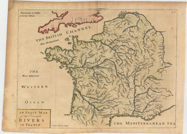
This map focuses on the system of rivers and canals in France. The map was published in Philipp Cluver's Introductio in Universam Geographicam, a popular atlas that appeared in over 45 editions during a 100-year period. The first edition was published without maps in the 1620s, and the first edition to include maps was published circa 1641. The various editions were published in different cities throughout Europe, including Amsterdam, Nuremberg, and London. This map is from a London edition, with the majority of the maps re-engraved by John Senex.
References: Shirley (BL Atlases) T.CLUV-9a #6.
Condition: B+
Nice impression and color with one tiny hole. Issued folding with minor toning in the image and moderate toning along the top and left edges of the sheet.