Subject: Chile
Period: 1854 (circa)
Publication: Historia de Chile
Color: Hand Color
This lot features six maps and a battle plan from Claude Gay's Historia de Chile, published in Paris by Thunot. Gay was a French botanist and naturalist and carried out some of the earliest investigations into Chile's geography, geology and fauna. His work lasted for over 11 years and yielded an impressive 30 volume account (28 volumes of text and 2 atlas volumes). The maps offered include:
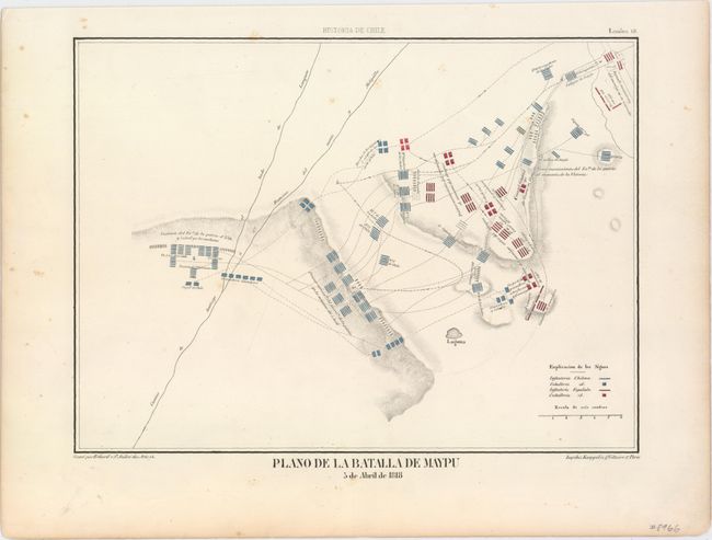
A. Plano de la Batalla de Maypu 5 de Abril de 1818, (11.4 x 8.4"). Shows both Chilean and Spanish troop positions during the Chilean War of Independence. Condition: Just a few spots of foxing mostly in the blank margins. (A)
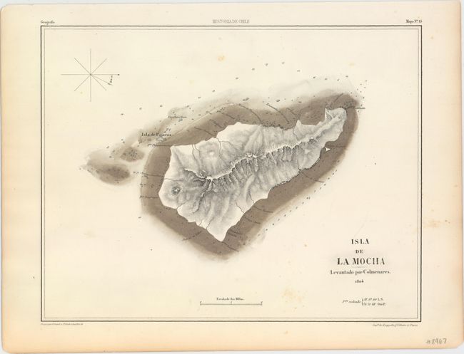
B. Isla de la Mocha Levantado por Colmenares. 1804, (11.8 x 9.3"). Depicts Mocha Island off the coast of Chile. The island had a number of historic shipwrecks, and numerous soundings and shoals are identified on the map. Condition: Just a few spots of foxing. (B+)
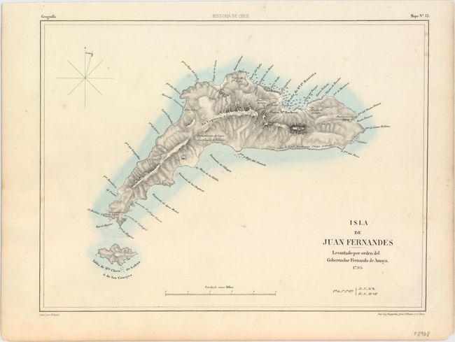
C. Isla de Juan Fernandes Levantado por Orden del Gobernador Fernando de Amaya. 1795, (12.2 x 9.2"). Depicts two of the three Juan Fernandez islands in the Pacific Ocean with topography and soundings noted. Condition: Just a few spots of foxing mostly in the blank margins. (A)
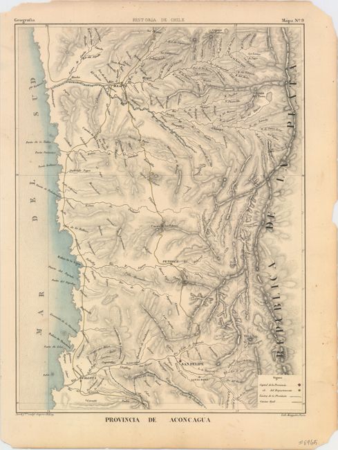
D. Provincia de Aconcagua, (9.3 x 12.4"). Shows detailed topography, departmental capitals and roads. Condition: A few edge chips confined to the blank margins. (A)
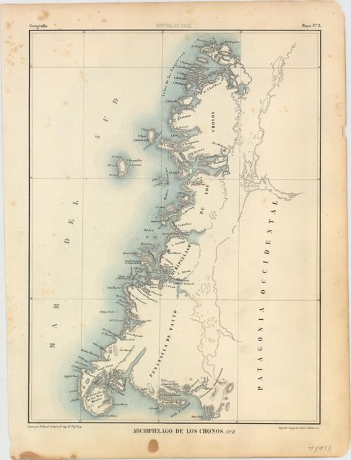
E. Archipelago de los Chonos. (No. 1), (9.2 x 12.3"). Displays good coastal detail with a nearly blank interior. Condition: Just a few spots of foxing in the image and a few small stains in the blank margins. (B+)
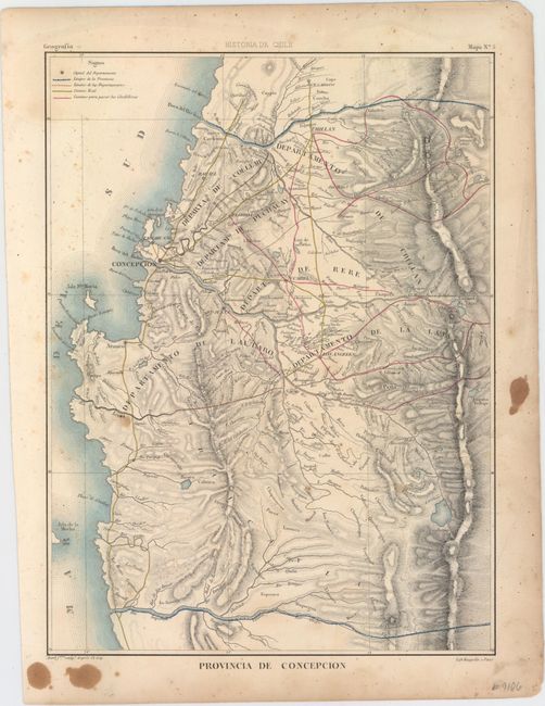
F. Provincia de Concepcion, (9.3 x 12.4"). Shows detailed topography, departmental capitals and roads. Condition: Light foxing in the image and a few stains in the blank margins. (B)
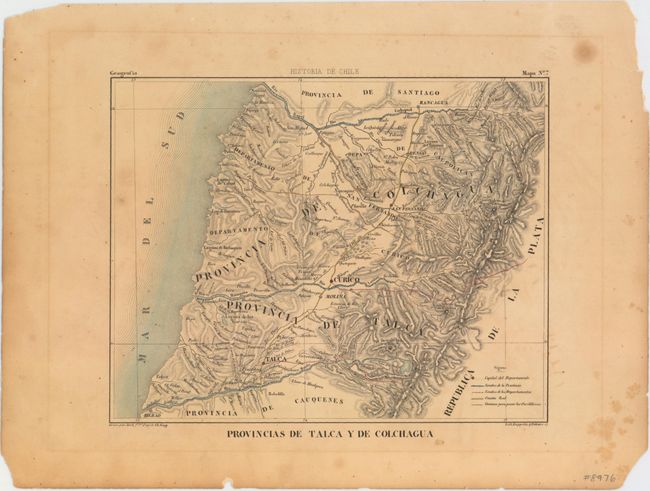
G. Provincias de Talca y de Colchagua, (9.7 x 7.6"). Depicts the rugged terrain of the region along with roads and political boundaries. Condition: Light toning with scattered foxing and a hint of offsetting. (B)
References:
Condition:
See description above.