Subject: Barbados
Period: 1752 (circa)
Publication: A Complete System of Geography
Color: Hand Color
Size:
16.8 x 13.9 inches
42.7 x 35.3 cm
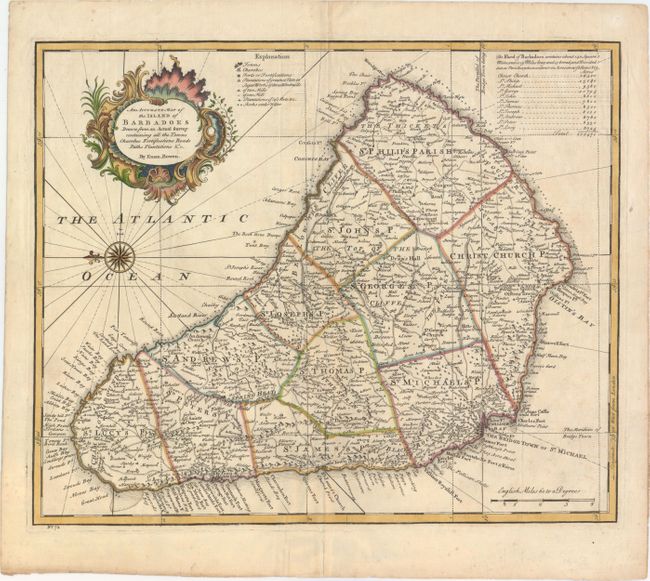
This beautiful map is based on William Mayo's important survey of the island between 1717 and 1721. Mayo's was the second systematic, and first large-scale survey and it fixed the legal bounds of the parishes. It was not until the Admiralty survey of 1873 that Mayo's map ceased to be the standard representation for maps of Barbados. The map shows the eleven parishes and depicts the ports, settlements, forts, churches, roads, and sugar plantations. A table at top right lists the eleven parishes with the acreage of each. A handsome chart with a fancy compass rose and a decorative cartouche.
References: Campbell (MCC-21) #29; Shirley (BL Atlases) T.BOW-2c.
Condition: B+
A nice impression with attractive color, a light crease adjacent to centerfold, and a professionally repaired worm track on the centerfold along the western shore of the island. There are some separations that have developed along the plate mark, all of which have been closed with archival material.