Catalog Archive
Auction 152, Lot 337

"An Accurate Map of the Island of St. Christopher, Vulgarly Called St. Kits. Containing All the Towns, Parishes, Forts &c.", Bowen, Emanuel
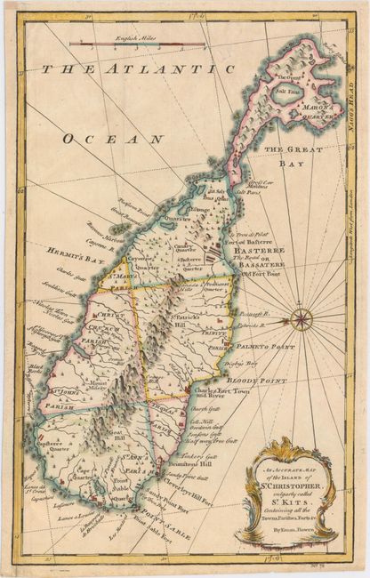
Subject: St. Kitts

Period: 1747 (circa)

Publication: A Complete System of Geography…

Color: Hand Color

Size:
8.7 x 13.9 inches
22.1 x 35.3 cm
Download High Resolution Image
(or just click on image to launch the Zoom viewer)

This detailed map of St. Kitts is oriented with east at the top and depicts numerous small towns, parishes, and the topography of the island. The map is adorned with a baroque-style title cartouche. This map was printed on a sheet with a map of Bermuda, which has been separated in this example.

References: Shirley (BL Atlases) T.BOW-2a #64.

Condition: B+

A nice impression with a short, archivally repaired tear at top, minor manuscript notations in borders, and a soft extraneous crease. Remargined at left with a small portion of neatline replaced in facsimile.

Estimate: $220 - $250

Sold for: $160

Closed on 2/18/2015

Archived