Subject: Southwestern United States & Mexico
Period: 1853 (dated)
Publication: Sen. Ex. Doc. No. 41, 32nd Congress, 2nd Session
Color: Black & White
Size:
6.2 x 10.2 inches
15.7 x 25.9 cm
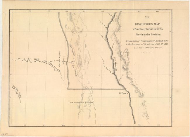
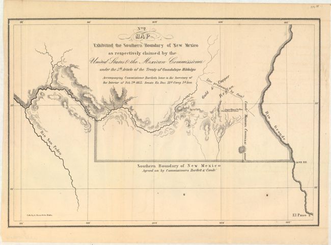
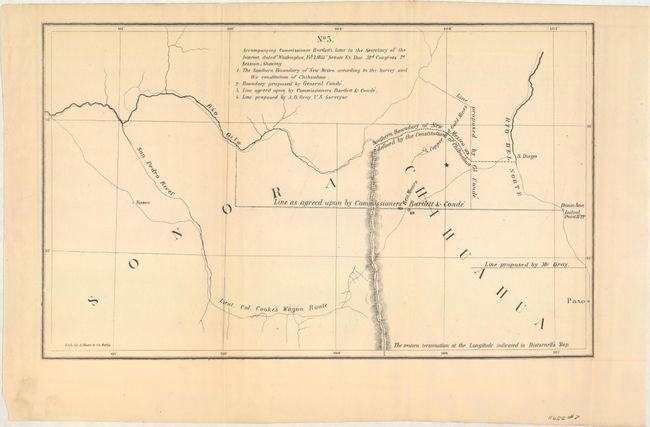
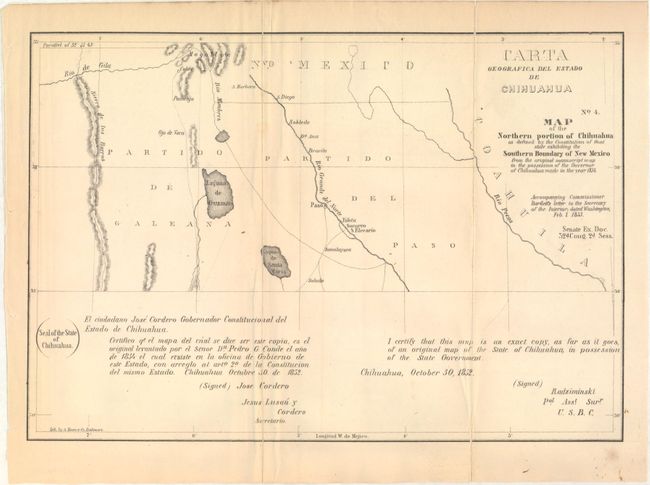
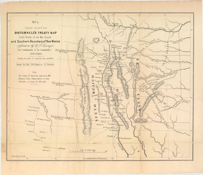
An important document with its five maps relating to grave errors in Disturnal's Treaty Map of 1847, the incorrect position of El Paso and an error in the course of the Rio Grande River. Bartlett was authorized to mark the line of the boundary between the U.S. and Mexico. In the execution of his task, these errors were discovered. The included copies of correspondence provided detailed background regarding the resolution of these errors. The maps included are:
A. Disturnel's Map Exhibiting the Error in the Rio Grande's Position (10.8 x 7.8").
B. Map Exhibiting the Southern Boundary of New Mexico as Respectively Claimed by the United States & the Mexican Commissioner (11 x 7.4").
C. Accompanying Commissioner Bartlett's Letter to the Secretary…[Four Proposed Boundaries] (11.8 x 7.2").
D. Carta Geographica del Estado de Chihuahua / Map of the Northern Portion of Chihuahua… (11 x 7.5").
E. That Part of Disturnal's Treaty Map in the Vicinity of the Rio Grande and Southern Boundary of New Mexico… (11 x 8.6").
Included with the map is 32 pp. of text from the report. Hardbound in quarter blue cloth over decorative blue boards.
References: Wheat [TMW] #771-774
Condition: B+
Maps are very good to near fine with pleasant light toning. Maps D and E above are backed with tissue to reinforce and repair numerous fold separations. Text is lightly toned with a few spots of foxing. New binding is flawless.