Catalog Archive
Auction 152, Lot 29

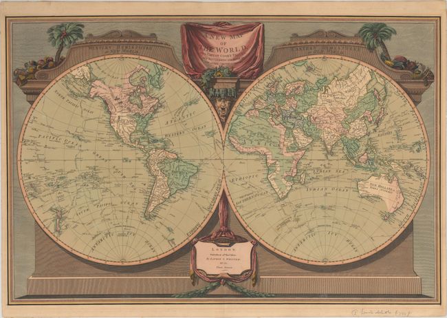
"A New Map of the World, with Captain Cook's Tracks, His Discoveries and Those of the Other Circumnavigators", Laurie & Whittle

Subject: World

Period: 1800 (dated)

Publication:

Color: Hand Color

Size:
28.2 x 18.8 inches
71.6 x 47.8 cm
Download High Resolution Image
(or just click on image to launch the Zoom viewer)

This attractive, double-hemisphere world map outlines the numerous tracks of Captain Cook on his three major voyages. Cartographically, Alaska is coming into form but still somewhat misshapen, New Zealand is completely mapped, and just a bit of Australia's southern coastline is incomplete. Surrounded by an architectural border with the hemispheres adorned by a pediment identifying the Old and New Worlds. Decorated by a drape-style title cartouche surrounded by flora, native costumes and weaponry.

References:

Condition: B+

A dark impression on "J Whatman" watermarked paper with two professionally repaired tiny holes in blank areas of the Pacific Ocean and light, even-age toning. Remnants of paper tape along the sheet edges on verso.

Estimate: $1,400 - $1,700

Sold for: $3,250

Closed on 2/18/2015

Archived