Subject: Southwestern United States & Mexico
Period: 1811 (dated)
Publication:
Color: Black & White
Size:
10.4 x 8.4 inches
26.4 x 21.3 cm
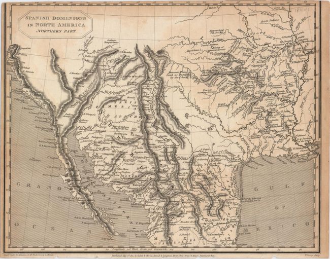
This is the smaller issue of Pinkerton’s map, which is based upon Humboldt's map of Mexico, including the graphic representation of the Rocky Mountains and Rio Grande River valley. The map presents a remarkable, emerging picture of the major watersheds originating in the Rocky Mountains -- a region long misrepresented on maps of the area. On the western slope, the headwaters of the Colorado are formed and the erroneous R. Buenaventura flows into a partially shown Salt Lake. On the eastern part of the map the Platte, Arkansas and Red Rivers are all delineated in great detail, and the course of the R. del Norte (Rio Grande) is equally well presented with mountains depicted by hachure. Filled with place names including towns, forts, and Indian regions. Title is in a medallion-style cartouche at upper left.
References:
Condition: B
Trimmed to inside the neatline at top with faint damp stains along the border at top, right and left.