Subject: Charleston, South Carolina
Period: 1865 (dated)
Publication: Annual Report of the Secretary of the Navy
Color: Hand Color
Size:
24.5 x 21.5 inches
62.2 x 54.6 cm
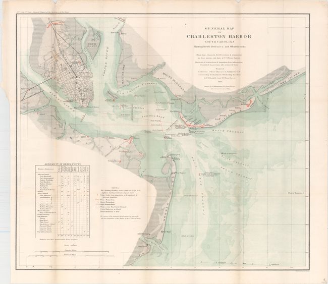
This fascinating map was produced under the direction of Rear Admiral J.A. Dahlgren U.S.N. commanding South Atlantic Blockading Squadron, by C.O. Boutelle Asst. U.S. Coast Survey. It shows the surveys of the shore line, channels, and fortifications with the location of Union and Rebel Batteries shown in color. It details positions of shipwrecks, obstructions, and torpedoes including the Housatonic, Keokuk, Flamingo, and many more. Tracks of numerous torpedoes are detailed. Many interesting notes include one giving the position of Ironsides as it lay over a 2,000 pound torpedo for "one hour" on April 7th, 1863. Table at lower left, Armament of Rebel Forts and notes explain the various symbols on the map. Charleston is shown as a detailed street grid. Possibly the best chart of Charleston Harbor produced during the Civil War. Extends to include Forts Shaw, Marshall, Sumter, Wagner and Johnson, plus many batteries.
References:
Condition: B+
Issued folding with faint toning along the folds and a 1.2" binding tear at upper left closed on verso with archival tape.