Subject: New York
Period: 1831 (dated)
Publication:
Color: Hand Color
Size:
20.5 x 19.7 inches
52.1 x 50 cm
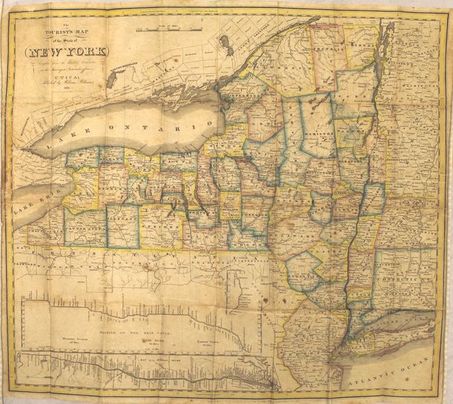
This scare pocket map was designed to guide immigrants on the way west using the newly completed Erie Canal. It shows the counties in a rich, lovely outline color with detail of town, cities, rivers and lakes. County development is current as of 1828. There are two insets; "Profile of the Erie Canal" and "Map of the Hudson River." This edition does not contain a panel of descriptive text along the right side of the map found on some earlier examples. Map folds into original brown leather covers (3.3 x 5.4") with gilt-stamped title.
References: cf. Phillips (Maps), p.510.
Condition: B
Issued folding and backed with tissue to reinforce and repair several short splits along the folds. There are a few repaired edge tears and minor loss of the left border where the map is adhered to the boards. Minor staining. Light abrasions and wear to the covers.