Subject: Missouri
Period: 1824-1833 (circa)
Publication:
Color: Hand Color
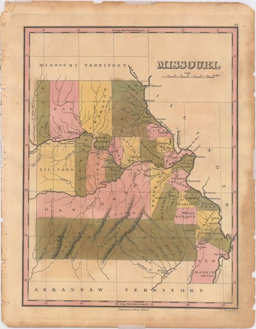
A. Missouri, by Anthony Finley, from A New General Atlas, circa 1824 (8.8 x 11.3"). Lovely map of the state that was engraved less than three years following statehood. The map details the county seats, towns and settlements. Development is along the rivers with virtually no other settlements noted in this early and fascinating map. The map shows 27 counties, correct for 1824, includes the 1824 gain from Girardeau county by Scott. Crisply engraved by Young & Delleker. Condition: Original color with light toning, faint color offsetting from an opposing page, and small edge tears and chips confined to the blank margins. (B+)
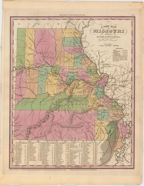
B. A New Map of Missouri with Its Roads & Distances, by Henry Schenck Tanner, from Tanner's Universal Atlas, dated 1833 (10.4 x 13.0"). This map was published approximately 9 years after the map above and also shows development mostly confined to the Mississippi and Missouri Rivers. Thirty-eight counties are depicted along with the Bounty Lands in the north. The large Ripley and Crawford counties occupy much of the south. A table at bottom indicates canal distances from St. Louis to Shawnee Township, St. Louis to Prarie du Chien, and St. Louis to the Kansas River. Condition: Original color with one short edge tear confined to the lower blank margin and closed on verso with archival tape. (A)
References:
Condition:
See description above.