Subject: Atlanta, Georgia, Civil War
Period: 1874-77 (dated)
Publication:
Color: Printed Color
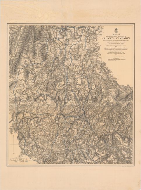
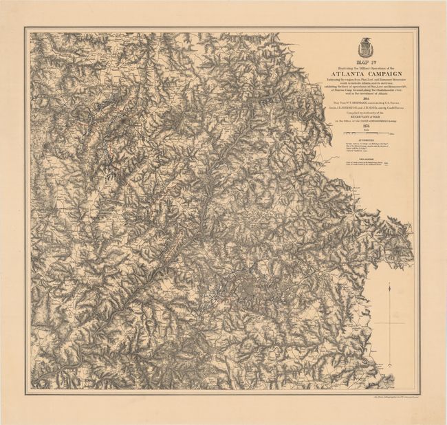
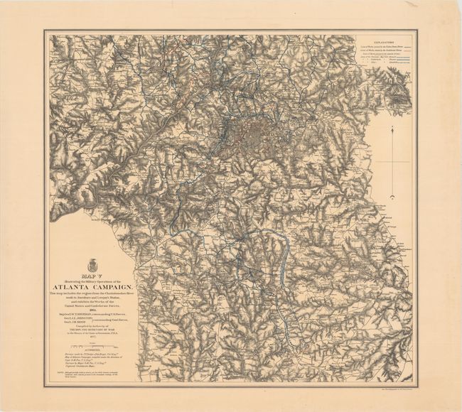
Nice set of maps with blue and red overprinting showing the lines of works of the Union and Confederate forces, and lines of march pursued by the separate armies, illustrating the events of Sherman's Atlanta Campaign during the spring and summer of 1864. Topography is rendered by finely drawn hachures. Towns, roads and numerous individual home sites are shown, identifying the landowners by name. Important battlefield sites of the campaign are shown, named and dated. List of maps includes:
A. Map II Illustrating the Military Operations of the Atlanta Campaign. This Map Includes the Region from Resaca on the North to Ackworth on the South..., dated 1877 (25.0 x 27.7"). Condition: There is a long tear extending from the top edge of the sheet down two-thirds of the map image that has been closed on verso with archival tape. Faint damp stains in top blank margin. (B)
B. Map IV Illustrating the Military Operations of the Atlanta Campaign Embracing the Region from Pine, Lost and Kennesaw Mountains..., dated 1874 (26.3 x 24.6"). Condition: On a clean, bright sheet. (A)
C. Map V Illustrating the Military Operations of the Atlanta Campaign. This Map Includes the Region from the Chattahoochee River South to Jonesboro and Lovejoy's Station..., dated 1877 (26.3 x 25.3"). Condition: On a clean, bright sheet with some creasing and tiny tears along edges of sheet, far from image. (A)
References: Stephenson (CW) #131.
Condition:
See description above.