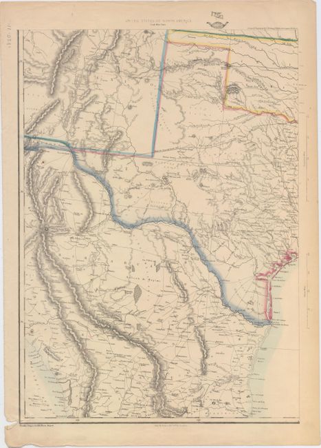
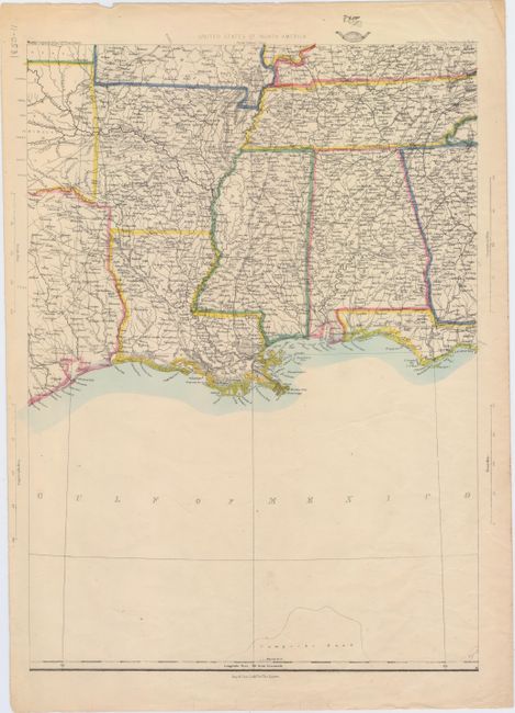
Subject: South Central United States
Period: 1861 (circa)
Publication: Weekly Dispatch Atlas
Color: Hand Color
Size:
12 x 17.3 inches
30.5 x 43.9 cm
These two sheets (of a six-sheet map) cover the southern United States from Texas east to the Florida panhandle. Two proposed routes for a Pacific Railroad are shown form Ft. Smith: one through Indian Territory (Whipple route) and another southerly route through Texas and along the Mexican border (Parke/Pope route). Just below New Mexico Territory is a tiny sliver of Arizona, referring to the Confederate Territory of Arizona. Numerous forts and Indian tribes are located, and there is good detail of roads, towns rivers, and topography throughout.
The Weekly Dispatch Atlas was published in monthly segments for subscribers of the Weekly Dispatch newspaper. The monthly editions eventually grew to include maps covering most of the known world. Published in various editions from 1855 through the early 1880s. Each map has the Dispatch Atlas seal above the title or in the margin.
References:
Condition: B+
The map sheets are in very good condition with a few edge tears mostly confined to the lower blank margins. The southwest sheet has an edge tear at bottom left that extends 0.5" into the image.