Subject: Colonial Southern United States
Period: 1740 (circa)
Publication: Atlante Novissimo…
Color: Black & White
Size:
16.8 x 12.8 inches
42.7 x 32.5 cm
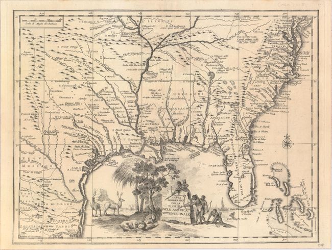
Finely engraved copper plate map of the southeast part of North America based on Delisle. It covers the region from Filadelfia south to the Bahamas, and the coast of the Gulf of Mexico to Tampico. It shows the same area as Ortelius' 1584 map and several earlier maps, but most of the earlier names have been replaced with later names for rivers, towns and villages, and political divisions. The British colonies are confined east of the Apalache. The large pictorial title cartouche features natives aiming arrows at resting lions with elk in the background.
References: Cumming (SE) #277.
Condition: A
A very crisp and clean example on watermarked paper with just a hint of offsetting along the centerfold.