Catalog Archive
Auction 152, Lot 145

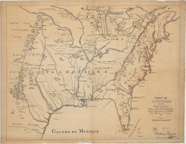
"Carte de la Louisiane et des Pays Voisins Dediee a M. Rouille Secretaire d'Etat Ayant le Departement de la Marine", Bellin, Jacques Nicolas

Subject: Eastern United States

Period: 1850 (circa)

Publication:

Color: Hand Color

Size:
22.4 x 17.4 inches
56.9 x 44.2 cm
Download High Resolution Image
(or just click on image to launch the Zoom viewer)

This is an anonymous manuscript copy of Bellin’s well-known engraved map of the Eastern United States, covering the region from the Great Lakes to Florida, and from the eastern seaboard west to Santa Fe. It shows the English colonies confined to east of the Appalachians, Spain in control of Florida, and the French in control of the Mississippi River Basin. The map was copied from an example at the Bibliotheque Nationale in Paris at some point during the middle of the 19th century. Additional notations in red manuscript (now faded to purple) indicate various forts in present-day Louisiana and Mississippi based upon Le Page du Pratz’s Hisotry of Louisiana.

Provenance: Sold at Bonhams in 2012. Click here to view the listing.

References:

Condition: B+

Backed on linen with some light toning at left and right and a few edge chips confined to the blank margins.

Estimate: $1,400 - $1,700

Sold for: $750

Closed on 2/18/2015

Archived