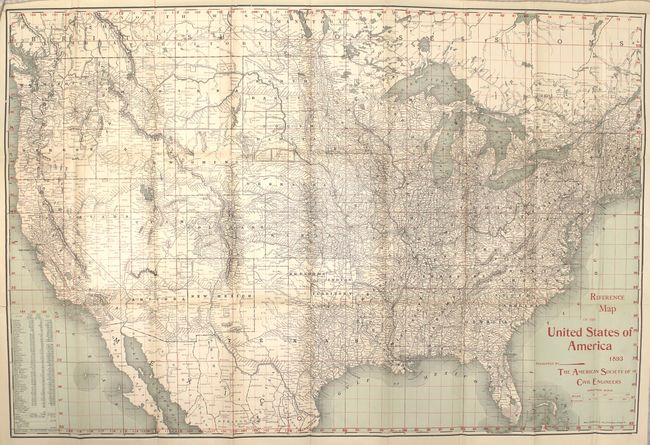
Subject: United States
Period: 1893 (dated)
Publication:
Color: Printed Color
Size:
30.5 x 20.5 inches
77.5 x 52.1 cm
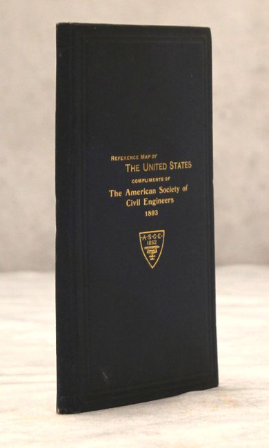
Very detailed and finely printed map with red over-printed latitude and longitude lines forming a grid. The map folds into cloth covers with title: "Reference Map of the United States Compliments of the American Society of Civil Engineers 1893." Hardbound in blue cloth with gilt titling (4.5 x 7.5"). Text (51 pp.) consists mostly of a list of major projects and manufactures, all keyed to the map with latitude and longitude indicated for each. On the title page is the disclaimer "This society is not responsible as a body for the facts and opinions advanced in any of its publications." A most unusual and scarce issue.
References:
Condition: A
Map is clean and bright and in near fine condition with just a couple of tiny fold separations closed on verso with archival tape. Covers have minor soil.