Subject: Nova Scotia, Canada
Period: 1827 (dated)
Publication:
Color: Black & White
Size:
31.3 x 23.6 inches
79.5 x 59.9 cm
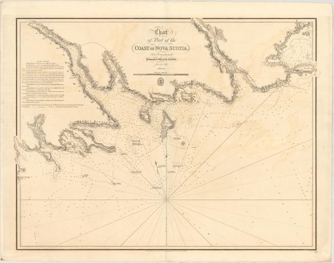
This uncommon chart gives detailed navigational information for the area around County Harbor along the southern shore of Nova Scotia, extending north to Tor Bay. Hundreds of soundings are given, along with depictions of rocks, shoals, and anchorages. Specific navigational directions for each of the harbors are explained at left. True north and magnetic north are given. The engraved seal of the Hydrographic Office and the price "Two S. Six P." appear below the nautical scale of miles. This is the first time we have ever seen this chart.
References:
Condition: B
A good impression on paper with a "Rush & Turners 1844" watermark. There is offsetting, a few spots of foxing, and a centerfold separation that enters less than 1" into image at bottom that has been closed on verso with archival tape.