Subject: Exploration and Surveys
Period: 1851 (dated)
Publication: Sen. Doc 3, 32nd Cong., 2nd Sess.
Color: Black & White
Size:
6 x 9 inches
15.2 x 22.9 cm
The Office of Coast Survey is the oldest U.S. scientific organization, dating from 1807 when Congress directed that a "survey of the coast" be carried out. By 1836, it was called the U.S. Coast Survey and in 1878, the name was changed to the U.S. Coast and Geodetic Survey. Today the Office of Coast Survey is a division of the National Oceanic and Atmospheric Administration NOAA.
The survey teams, composed of civilians as well as Army and Naval officers, charted the nation's waterways and produced a wide array of reports, survey charts, hydrographic studies of tides and currents, astronomical studies and observations, and coastal pilots. These charts are an important record of the changing nature of the nation's coastlines. In additional to coastal charts, the U.S. Coast and Geodetic Survey produced land sketches, Civil War battle maps, and the early aeronautical charts.
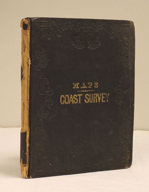
This is the attractive map edition that accompanies the Coast Survey report for 1851. It includes 56 of the 58 maps called for in the list of contents. Some of the more desirable charts include:
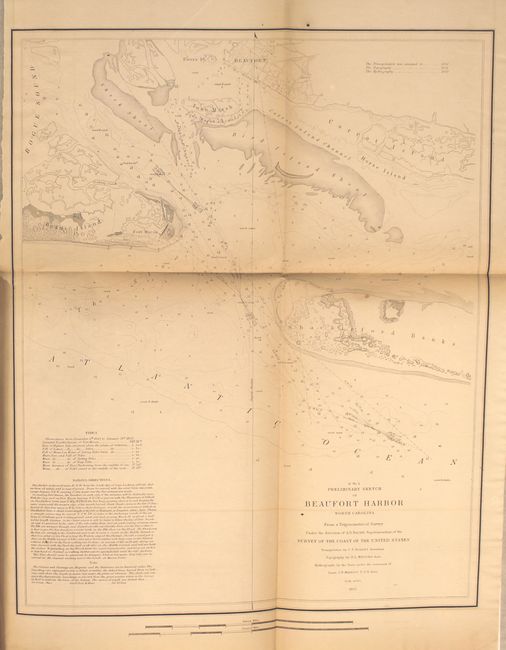
Sketch D, No. 5. Preliminary Sketch of Beaufort Harbor
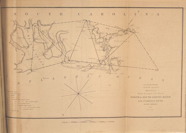
Sketch E, No. 3. Showing the Progress of the Survey at North and South Edisto Rivers and St. Helena Sound
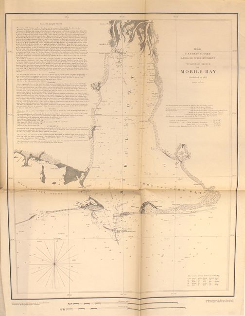
Sketch H, No. 10. Preliminary Sketch of Mobile Bay
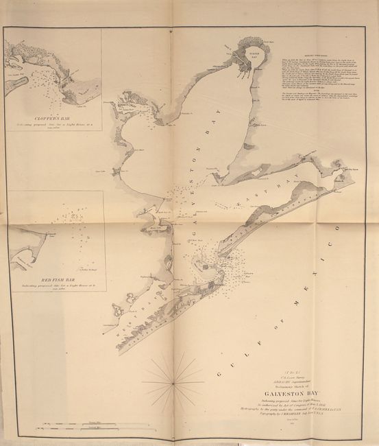
Sketch I, No.2. Preliminary Sketch of Galveston Bay
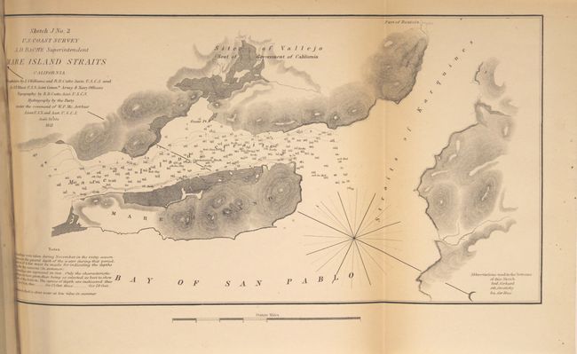
Sketch J, No.2. Mare Island Straits
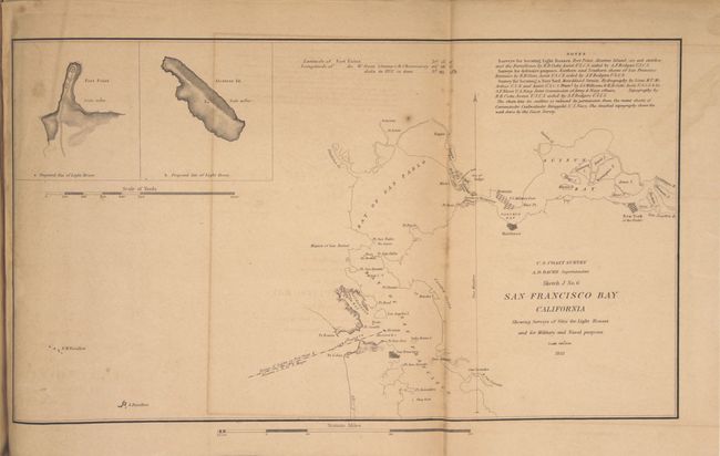
Sketch J, No. 6. San Francisco Bay
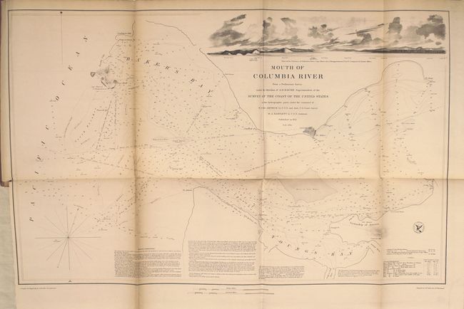
Sketch K. Mouth of the Columbia River and Cape Hancock
Missing maps are Preliminary Sketch of Hatteras Shoals and Sketch K, No 2. Mouth of the Columbia River. Contains a list of contents, and 56 small and large folding maps. Hardbound in original embossed brown cloth boards with gilt title on front cover. 8vo.
References:
Condition: B
The maps are generally good with light to occasionally moderate toning and offsetting. The bottom third of the Sandy Hook map is nearly separated and the three "Reconnoissance of the Western Coast" maps and the Key West map each have a long centerfold separation spanning the map image. The covers are rubbed, the spine has nearly perished, and the front cover is starting to detach.