Catalog Archive
Auction 151, Lot 610

"Descriptio Acurata Terrae Promissae per Sortes XII [on sheet with] Terre Sainte Moderne que les Turcs, sous la Domination des quels Elle est, Auiourdhuy, Divise. Nt en Sangiacs ou Gouvernements", Fer, Nicolas de
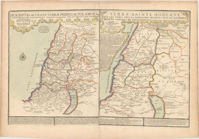
Subject: Holy Land

Period: 1770 (dated)

Publication:

Color: Hand Color

Size:
28.1 x 18 inches
71.4 x 45.7 cm
Download High Resolution Image
(or just click on image to launch the Zoom viewer)

This large, uncommon sheet contains two maps. On the left is an ancient map of the Holy Land that depicts the Promised Land divided into the twelve tribes. On the right is a 'modern' map that shows the region under Turkish rule and divided into provinces. The sheet provides a wealth of information, both in the maps and in the accompanying French text. The maps were created by Nicolas de Fer based on the work of Philippe de la Rue and first published in de Fer's Atlas ou Recueil de Cartes Geographiques circa 1720. The right-hand map has the publisher's imprint of Guillaume Danet, son-in-law and successor of de Fer, however this edition was published by Louis Charles Desnos, who reissued several of Danet's works, and whose imprint has been added to the left-hand map.

References:

Condition: B+

Very light soiling.

Estimate: $400 - $475

Sold for: $210

Closed on 11/19/2014

Archived