Catalog Archive
Auction 151, Lot 577

"Regionum Italiae Mediarum Tabula Geographica...", Delisle/Covens & Mortier

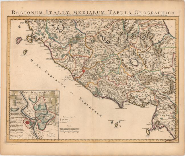
Subject: Central Italy

Period: 1730 (circa)

Publication:

Color: Hand Color

Size:
24.3 x 17.8 inches
61.7 x 45.2 cm
Download High Resolution Image
(or just click on image to launch the Zoom viewer)

This handsome map of central Italy is roughly centered on Rome, and extends from Lake Bolsena and the town of Spoleto in the north, to Naples in the south. The map is filled with details of towns, an extensive road system, political boundaries, aqueducts, rivers, and mountains. Fucinus Lacus (Fucine Lake), which was drained in 1875, is prominently depicted east of Rome. At bottom left is an inset of the Seven Hills of Rome to the east of the Tiber River, with the Vatican Hill and the Janiculum Hill to the west.

References:

Condition: A

A nice impression with original color, a hint of offsetting, and a few tiny spots.

Estimate: $240 - $300

Sold for: $120

Closed on 11/19/2014

Archived