Subject: Eastern Germany
Period: 1730 (circa)
Publication: Grosser Atlas...
Color: Hand Color
Size:
22.5 x 19.3 inches
57.2 x 49 cm
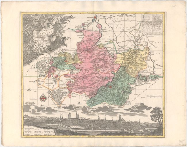
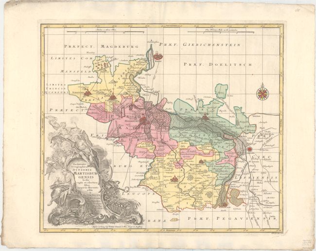
This is a matched pair of maps of the region surrounding Merseburg and Naumburg, just east of Leipzig. The maps present excellent detail of the region, including roads, towns of various sizes, individual houses, mills, churches, and much more. The cities are illustrated as towers closely surrounded by buildings, which vary in size according to the size of the actual town. Engraved by Tobias Conrad Lotter.
A. Episcopatus Numburgensis et Cizensis Delineatio Geographica… This map shows the region just to the south of Merseburg, with Naumburg to the west and Zeitz to the south. At bottom is a lovely bird's-eye view of Naumburg, with many buildings identified with a numbered key. The allegorical title cartouche features Athena and putti.
B. Delineatio Geographica Ditionis Martisburgensis Hodie Regiis et Electoralibus Auspiciis Florentis Edita. Striking and meticulously detailed map of the area around Merseburg in eastern Germany, extending to the town of Halle in the north, Leipzig in the east and Lutzen in the south. The cartouche is what is truly amazing on this map - it is a cascading, richly Baroque concoction filled with angels, cherubs and the Holy Grail held by a maiden who has her foot on a grim torso.
References:
Condition: A
Bold original color with minor printer's ink residue and minor soiling in wide margins. Sheets are deckle-edged. The second map has a tiny tear along the centerfold just above the city view only visible when held to light.