Catalog Archive
Auction 151, Lot 450

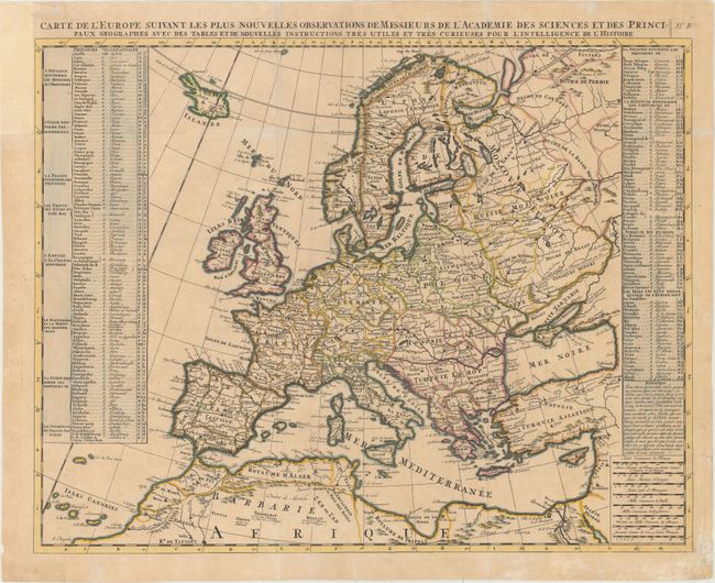
"Carte de l'Europe Suivant les Plus Nouvelles Observations de Messieurs de l'Academie des Sciences et des Principaux Geographes avec des Tables et de Nouvelles Instructions Tres Utiles et Tres Curieuses pour l'Intelligence de l'Histoire", Chatelain, Henry Abraham

Subject: Europe

Period: 1705 (circa)

Publication: Atlas Historique

Color: Hand Color

Size:
23.2 x 18.1 inches
58.9 x 46 cm
Download High Resolution Image
(or just click on image to launch the Zoom viewer)

Handsome map of Europe with extensive tables listing more than 175 kingdoms/nations with the name of the main city for each. The map extends to include Iceland, all of Russia, the Black Sea, and Northern Africa with good detail throughout. Beautifully engraved in Chatelain's crisp style.

References:

Condition: B+

Issued folding with archival repairs to a few short fold separations and two tiny holes at fold intersections and to a tear that enters 1" into map at bottom. There is light toning, some minor soiling, and a few small worm holes that have been professionally infilled. A binding trim at top left has been replaced with old paper to accommodate framing.

Estimate: $275 - $350

Unsold

Closed on 11/19/2014

Archived