Catalog Archive
Auction 151, Lot 390

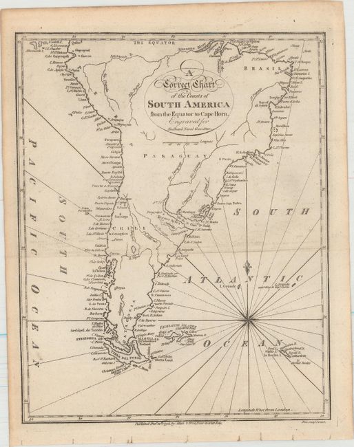
"A Correct Chart of the Coasts of South America from the Equator to Cape Horn. Engraved for Malham's Naval Gazetteer", Malham, John (Rev.)
Subject: South America

Period: 1795 (dated)

Publication: Malham's Naval Gazetteer

Color: Black & White

Size:
7.5 x 9.4 inches
19.1 x 23.9 cm
Download High Resolution Image
(or just click on image to launch the Zoom viewer)

This chart of South America is dense with names along its coastlines. Rivers are tracked inland, but otherwise there is little information provided about the interior of the continent. In addition to a number of smaller islands, the Falkland Islands and Terra del Fuego (which appears as one large island with a few small satellites) are identified. The chart was engraved by Neele for Rev. John Malham (1747-1821), a writer and teacher of navigation, for Malham's The Naval Gazetteer; or, Seaman's Complete Guide.

References: McCorkle (18th C. Geography Books) #251, Vol. I-6.

Condition: A

Issued folding with faint offsetting.

Estimate: $80 - $100

Unsold

Closed on 11/19/2014

Archived